Monitoring guidance
-
Overview
Foundations for an effective and inclusive environmental monitoring program
Stewardship of Alberta’s environment and informed decision-making require the best available knowledge from scientific, Indigenous and community-based ways of knowing.
The Government of Alberta conducts environmental monitoring activities under the Environmental Protection and Enhancement Act and various other legislation.
Lead by the Chief Scientist, Alberta’s Environmental Science Program (AESP) provides environmental science data, information and reporting on the condition of Alberta's environment. Delivery of the AESP also utilizes the application of a multiple evidence-based approach to grow our understanding of the environment. This approach recognizes that scientific, Indigenous and community-based scientific knowledge systems are equally valid and complementary. Bringing these knowledge systems together ensures the AESP offers inclusive and holistic information for the public and environmental decision-makers.
-
Indigenous knowledge and citizen science
Indigenous community-based monitoring and knowledge
Alberta’s Environmental Science Program receives advice from the Indigenous Wisdom Advisory Panel on how to respectfully include Indigenous knowledge and Indigenous knowledge holders in Alberta’s monitoring, evaluation and reporting activities. This includes the documentation and sharing of Indigenous knowledge through Indigenous community-based monitoring initiatives like the Indigenous Lake Monitoring Program and the Indigenous Climate Change Observation Network.
Citizen science
Many Albertans already contribute data to help understand the condition of Alberta’s environment, including reporting grizzly bear sightings, listening to amphibian calls and monitoring water quality.
To better support these efforts, the Citizen Science Principles of Good Practice were co-developed by the Government of Alberta and the Miistakis Institute, with guidance and input from external organizations, researchers and practitioners. This guide offers effective practices for the appropriate application of citizen science in Alberta.
The Alberta government continues to connect with practitioners across Alberta to grow communities of practice and support citizen science initiatives like:
- Lakewatch: the Alberta Lake Management Society’s citizen science program collects water quality data from 25 to 30 lakes annually.
- GrizzTracker: an online mapping tool developed to enable Alberta’s citizens and industrial field staff to report grizzly bear sightings in the Lower Peace Region of Alberta.
- Alberta’s volunteer amphibian monitoring program: a long-term community survey of amphibians contributing to an improved understanding of the distribution and general status of amphibians in Alberta.
- Alberta Community Bat Program: the Government of Alberta has partnered with the Wildlife Conservation Society of Canada’s to work with communities to monitor bat populations across the province.
The Chief Scientist explains how these citizen science initiatives help answer questions on Alberta’s environment and contribute to data and information gaps: Advancing citizen science in Alberta.
-
Cumulative effects
Cumulative effects are caused by the accumulation of impacts on the environment from multiple activities over time. One impact by itself may not result in environmental change, however the addition of many small impacts over time can result in larger cumulative and potentially adverse impacts to the environment.
Monitoring change in Alberta’s environment – including air, water, plants, land, wetlands, fish, wildlife and climate – informs the assessment of cumulative effects over time and space. To determine whether observed changes are acceptable, monitoring data is compared to threshold values and, if thresholds are crossed, corrective action is taken when required. This system of monitoring, evaluating, reporting and responding to undesirable changes in environmental indicators are key elements in Alberta's environment and land use planning approach delivered through Alberta’s Land Use Framework.
Province-wide monitoring networks collect the data required to inform the management of cumulative effects, and results are currently reported through annual status reports on air quality, water quality and water quantity. To learn more, explore the annual regional assessments describing the status of air and water indicators evaluated against management thresholds in the environmental management frameworks in the Lower Athabasca Region and South Saskatchewan Region.
Environmental management frameworks are currently implemented for surface water quality, surface water quantity and air quality. The air quality and surface water quality frameworks are supported by monitoring data collected from provincial long-term monitoring networks.
Alberta’s environmental monitoring programs are also evolving towards an adaptive design to improve understanding of how cumulative effects impact Alberta's environment. By critically considering site selection, sampling frequencies and relevant parameters, an adaptive design can create optimal monitoring programs for detecting environmental change.
Alberta government scientists are developing and implementing adaptive monitoring programs that enhance our understanding of status, trends and changes in Alberta’s ecosystems. Networks which monitor Alberta’s air, water, plants and land, fish and wildlife, and climate are continuously undergoing review to define and focus the monitoring objectives and science questions that need to be answered to characterize cumulative effects on our environment. See 'Indigenous knowledge and citizen science' above.
Learn more about the objectives and science questions guiding monitoring programs in Alberta’s rivers and streams.
-
Scientific standards and quality
Alberta government scientific activities are built on a foundation of standardized methods and quality control processes which ensure consistency and comparability in the collection and analysis of data. This includes:
- auditing industrial emission data to ensure compliance with industrial approvals
- auditing ambient air data to ensure compliance with Alberta’s Air Monitoring Directive
- regular assessment and calibration of field and lab monitoring instruments
- adhering to ethical standards for transparent data collection, analysis and reporting
Scientists lead technical reviews and data quality assessments on an on-going basis to ensure standardized methods and protocols are implemented across the province. This continuous review and improvement of our scientific standards and processes ensures that we are providing credible information on the condition of Alberta’s environment to decision-makers. New standards and protocols are developed and employed when gaps are identified or when advances in monitoring methodologies and technologies are made.
Standard operating procedures
See the environmental approvals and assessment section for information.
Air

-
About air monitoring
The provincial air quality and deposition monitoring, evaluation and reporting program provides information to the government, stakeholders and the public that is used to protect human health and the environment.
Long-term air quality monitoring
In Alberta, there is a province-wide network of permanent stations which monitor air quality 24 hours a day, 7 days a week. Air quality is continuously monitored for 13 parameters at more than 70 monitoring stations across Alberta, primarily deployed within or near population centres. Data are compared to regional, provincial and national standards and objectives to ensure the health and safety of Albertans and the environment. Information from this monitoring network informs the Air Quality Health Index, which reports current air quality results to the public.
Long-term deposition monitoring
In Alberta, there is a province-wide network of deposition monitoring stations which collect weekly samples to inform the transfer of atmospheric pollutants such as acidifying substances and base cations to sensitive ecosystems. There are 6 wet deposition monitoring stations and one total deposition (wet and dry deposition) monitoring station across Alberta, which collect regionally representative samples. Data collected at these stations support the Acid Deposition Management Framework, environmental impact assessments and national and international (Canada-United States) acid deposition science assessments.
There are also regional deposition monitoring networks in the Athabasca and Cold Lake Oil Sands Regions that are funded through the Oil Sands Monitoring Program. These regional networks are operated by the Wood Buffalo Environmental Association (WBEA) and Lakeland Industry and Community Association (LICA) and measure total deposition co-located with soil and vegetation monitoring to assess the effects of deposition on ecosystems.
Short-term monitoring
Short-term monitoring is deployed when air quality and deposition data are needed in areas not covered by existing monitoring infrastructure. Short-term monitoring provides data to address air quality and deposition concerns from stakeholders and the public, including emergency response support during wildfire smoke events.
Regulatory monitoring
Regulatory monitoring performed by industry is used to assess performance of industrial activities to meet policy and management outcomes. The objective of regulatory monitoring is to verify that industrial facilities are operating within approved conditions and provide information on the effect of industrial activities on the environment.
Emerging air monitoring methods
Emerging monitoring methods, such as low-cost air quality sensors, are evaluated in partnership with stakeholders on an ongoing basis. This work supports an adaptive monitoring design, which has the flexibility to deploy alternative technologies in short-term monitoring studies or to fill gaps in long-term monitoring to meet monitoring objectives.
-
Collection types
Continuous ambient air quality monitors
Continuous monitoring provides nearly instantaneous measurements of pollutant concentrations averaged to a desired frequency (for example, 5-minutes or hourly). Air is drawn through an analyzer calibrated to produce an output that is proportional to the ambient pollutant concentration.
Currently, the Alberta Air Data Warehouse includes continuous monitoring measurements from all ambient air monitoring stations operated by airshed organizations and the Government of Alberta.
Data are available from permanent and portable stations, as well as some mobile/temporary stations, from 1986 to the present. Many of these stations are included in the provincial long-term air quality monitoring network.
- Typical parameters monitored: PM5, NH3, CO, H2S, NO, NO2, NOx, O3, SO2, TRS, THC, NMHC, CH4
- Sampling frequency: Continuous, reported to 1-hour averages
Precipitation chemistry
Precipitation sampling is used to measure the amount of airborne pollutants, which are captured and deposited by rain or snow falling on the land surface. This measurement – termed wet deposition – provides important information on potential sources of pollutants which can lead to acidification and eutrophication.
Precipitation chemistry monitoring stations are part of the provincial long-term deposition monitoring network.
- Typical parameters monitored: SO42-, NO3-, Cl-, NH4+, Na+, Ca2+, Mg2+, K+, PO4-
- Sampling frequency: Typically weekly
Passive samplers
Passive samplers measure concentrations of ambient air pollutants averaged over time-periods typically of one to 2 months. Air pollutants are adsorbed onto a filter or other surface through atmospheric diffusion (that is, a pump is not used to draw air through the sampling medium).
After a defined period of time the sample is collected and undergoes laboratory analysis for the pollutant(s) of concern. The mass of a pollutant collected on the filter and the estimated rate of uptake are used to determine the atmospheric concentration of the pollutant.
The Alberta Air Data Warehouse includes passive sampler data collected by airshed organizations to meet local air monitoring needs.
- Typical parameters monitored: SO2, NO2, O3, H2S
- Sampling frequency: Typically 1-to-2-month averages
Hi-Vol
A Hi-Vol collects total suspended particulate (TSP) and may be equipped with a size-selective inlet head for PM10 or PM2.5. The sample is sent to a laboratory for analysis.
- Typical parameters monitored: Mass of PM (TSP, PM10, or PM5), trace metals, elements, ions
- Typical sampling frequency: Intermittent/rotating schedule, 24-hour averaging period
Filter based
Filter based sampling collects total suspended particulate (TSP) and may be equipped with a size-selective inlet head for PM10 or PM2.5. The sample is sent to a laboratory for analysis.
- Typical parameters monitored: Mass of PM (TSP, PM10, or PM5), trace metals, elements, ions
- Typical sampling frequency: Intermittent/rotating schedule, 24-hour averaging period
Dichot
Collects PM in two streams, one for PM10 and one for PM2.5. The sample is sent to a laboratory for analysis.
- Typical parameters monitored: Mass of PM10 and PM5, trace metals, elements, ions
- Typical sampling frequency: Intermittent/rotating schedule, 24-hour averaging period
Speciation system
Collects total suspended particulate (TSP) and may be equipped with a size-selective inlet head for PM10 or PM2.5. The sample is sent to a laboratory for analysis.
- Typical parameters monitored: Mass of PM (TSP, PM10, or PM5), trace metals, elements, ions, elemental carbon, organic carbon
- Typical sampling frequency: Intermittent/rotating schedule, 24-hour averaging period
Canister
A whole air sample is drawn into a sampling container or vessel by opening a valve to draw the air into an evacuated canister. The canister is then analyzed in a laboratory for the desired suite of species.
- Typical parameters monitored: Suites of volatile organic compounds (VOCs) and sulphur-containing compounds
- Typical sampling frequency: Intermittent/rotating schedule, variable averaging periods (grab samples, 1 hour, 24 hours)
PUF sampler
A sampler equipped with a sorbent cartridge consistent of a sorbent mix including polyurethane foam (PUF). The sample is then sent to a laboratory for analysis.
- Typical parameters monitored: Polycyclic aromatic hydrocarbons (PAH)
- Typical sampling frequency: Intermittent/rotating schedule, with 24-hour averaging period
Dustfall (bucket)
A bucket collects dust.
- Typical parameters monitored: Mass per unit area of dust
- Typical sampling frequency: Typically monthly
-
Data
Air quality data
The public can access air data from monitoring stations operated by airshed organizations, the Government of Alberta and industry.
The Air Quality Health Index (AQHI) map provides real-time hourly air quality conditions for over 30 Alberta communities. AQHI data are also available via the WeatherCAN App.
The wildfire smoke portable air monitoring dashboard reports the impact of wildfire smoke on air quality throughout the wildfire season.
Deposition data
Alberta’s provincial deposition monitoring data are publicly available. Data from wet deposition stations can be accessed through the National Atmospheric Chemistry Database (NAtChem). For dry deposition stations, data from filter pack samples are available through the Clean Air Status and Trend Network (CASTNET) and data from ammonia passive samples are accessible from the National Atmospheric Deposition Program (NADP). Data from regional monitoring networks in the oil sands regions are available on the WBEA website and will soon be available on LICA’s website.
-
Condition of the environment
Access condition of the environment reporting to learn more about trends in key air quality indicators across Alberta.
-
Distributed Monitoring System
Air quality and atmospheric deposition monitoring in Alberta is delivered through a distributed system, which includes:
- airshed organizations
- industry
- provincial and federal governments
To ensure data consistency and quality, policies such as the Alberta Air Monitoring Directive have been established.
Airshed organizations
Airshed organizations are regional, multi-stakeholder, not-for-profit organizations that monitor, report and educate on ambient air quality.
Airshed organizations operate the majority of ambient monitoring stations across the province, including stations owned by the airshed organization and stations owned by the Government of Alberta or industry. There are 10 airshed organizations providing data to the Alberta Air Data Warehouse. For more information on airshed organizations, see:
- Alberta Airsheds Council
- Alberta Capital Airshed (ACA)
- Calgary Region Airshed Zone (CRAZ)
- Heartland Air Monitoring Partnership (HAMP)
- Lakeland Industry and Community Association (LICA)
- Parkland Airshed Management Zone (PAMZ)
- Palliser Airshed Society (PAS)
- Peace Airshed Zone Association (PAZA)
- Peace River Area Monitoring Program (PRAMP)
- West Central Airshed Society (WCAS)
- Wood Buffalo Environmental Association (WBEA)
Industrial facilities
Industrial facilities conduct ambient air monitoring as well as source emissions monitoring based on the requirements of their operating approval under the Environmental Protection and Enhancement Act. Industrial facilities follow reporting requirements under the Air Monitoring Directive and data is submitted to the Alberta Air Data Warehouse.
Ambient monitoring conducted by an industrial facility usually represents air quality at the facility fenceline. Source emissions monitoring represents what is coming out of facility stacks. Also see:
Government of Alberta
The Government of Alberta owns a number of air monitoring stations in Alberta and several of these stations are operated by airshed organizations under contract. In addition, the Government of Alberta provides oversight on:
- airshed organization and industry station operations
- data quality assurance and control
- data submission to the Alberta Air Data Warehouse
-
Monitoring, evaluation and reporting plan
The five-year provincial air quality and deposition monitoring, evaluation and reporting plan (MER plan) provides a framework for the work of the Airshed and Watershed Stewardship branch within the Resource Stewardship Division and allows for long-term clarity for partners and stakeholders. The goal of the MER plan is to work collaboratively with internal and external stakeholders to deliver activities on the following 3 key outcomes:
- Provide the data and information required to manage air quality and deposition within environmental limits.
- Report air quality information in real-time to inform the public and emergency response personnel about risk to human health.
- Share technical information on monitoring methods, and address current and emerging air quality and deposition issues.
Activities set out in the plan provide scientifically sound air quality and deposition monitoring, evaluation and reporting that inform decision-making on a provincial scale. The plan does not include:
- monitoring conducted within the provincial Oil Sands Monitoring Program
- monitoring for greenhouse gases
- evaluation of the current state of industrial regulatory monitoring
The implementation status of the MER plan is tracked and reported to stakeholders regularly.
Water
-
About water monitoring
We work collaboratively to monitor the quality and quantity of Alberta’s water resources year-round across province-wide networks of monitoring stations. These networks provides the data required to understand baseline conditions, natural variability, and quantify cumulative effects within Alberta’s lakes, streams, rivers and groundwater. Scientists, decision makers and the public use this information to understand if Alberta’s water resources are safe for recreational, domestic and traditional use, can meet the needs of the economy, and are able to support the diversity and health of plants and animals in Alberta’s ecosystems.
-
Water quality
Physical, chemical, and biological characteristics of our water are monitored and evaluated, including comparison to water quality guidelines to determine if management actions are required to protect our water.
Rivers and streams
Water quality monitoring of rivers and streams across Alberta consists of 3 programs:
- Long-term River Network
- Tributary River Network
- Quality Assurance and Quality Control Program
Long-term River Network
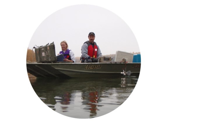
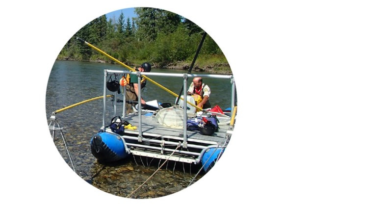
The Long-term River Network is a collection of sites located in a number of Alberta’s major river systems. Water is collected monthly at over 30 stations along 13 major rivers and is analyzed for over 100 parameters at analytical laboratories. Alberta’s major rivers provide a critical supply of water for drinking, ecosystem functioning, residential uses and industrial activities.
Tributary Monitoring Network
Under the Tributary Monitoring Network, water is also collected and analyzed monthly at over 70 tributaries that contribute water to many of Alberta’s major rivers. Tributaries are important systems to monitor as their water quality is more directly connected to the land use and land cover within the watersheds they drain. This information improves our knowledge of source water quality in major rivers, which informs decision makers about potential risks to our rivers.
The Tributary Monitoring Network in the North Saskatchewan River watershed was made possible through a multi-stakeholder partnership with EPCOR, the City of Edmonton and the North Saskatchewan Watershed Alliance. Within the Peace, Athabasca and Cold Lake oil sands regions, both major rivers and tributaries are monitored as part of the Oil Sands Monitoring Program.
Quality Assurance and Quality Control Program
All of our water quality data that are collected are part of the Quality Assurance and Quality Control Program. This program ensures the data collected meet the highest standards; this is done by developing and reviewing standard operating procedures, quantifying sources of uncertainty, and evaluating the performance of individual laboratories providing analytical services to our water quality programs.
Lakes
Data on water temperature, dissolved oxygen, and over 50 physical, chemical and biological water quality parameters is collected annually from approximately 30 lakes and reservoirs. To assess impacts of climate, near-real time data is collected from deployed monitoring buoys over the open-water season (typically June through September) for a network of sentinel lakes.
Lake monitoring is a collaborative effort among provincial staff, the Alberta Lake Management Society’s citizen science program Lakewatch, lake stewardship groups, and Indigenous communities. Data is used to understand baseline conditions and natural variability, changing conditions over time, and the impacts of environmental stressors on water quality – for example, watershed development and invasive species.
Groundwater
Groundwater quality is monitored in approximately 70 wells per year, on a rotating basis, through Alberta’s Groundwater Observation Well Network (GOWN). This network monitors more than 100 parameters in both near-surface and bedrock aquifers ranging from a few metres below the ground surface to greater than 100 m depth. Within the Peace, Athabasca and Cold Lake oil sands regions, groundwater quality is monitored as part of the Oil Sands Monitoring Program.
-
Water quantity
Rivers and streams
Water quantity in Alberta’s rivers and streams is monitored in partnership with the Water Survey of Canada at a network of over 400 hydrometric stations which provide continuous and near real-time information on water level and flow. The water quantity-monitoring network on rivers and streams includes stations that operate annually and those that operate seasonally (April to October).
Lakes
In partnership with the Water Survey of Canada, water levels at over 60 lakes and reservoirs are monitored continuously and data are transmitted in near real-time. In addition, provincial staff and citizen scientists (Lake Level Observers) manually monitor water level 3 times per year or more frequently in more than 200 lakes and reservoirs annually.
Groundwater
Groundwater levels are monitored hourly at more than 300 wells in the GOWN using digital water level loggers. Near real-time information on groundwater levels is available for approximately 50 of these wells.
Snow pack
Snow pack data is actively collected from over 100 alpine and plains sites as part of the Provincial Snow Survey Network. This includes a network of snow pillows reporting continuous snowpack data year-round, and a network of snow survey sites where snow depth is measured at monthly intervals throughout the winter and/or spring.
-
Data
Water quality data
Surface water quality data are available for rivers, lakes and reservoirs or can be accessed by contacting:
Email: [email protected]Groundwater data are available by contacting:
Email: [email protected]Water quantity data
The Alberta River Basins tool and the Water Survey of Canada provide access to near-real time water quantity data from rivers, lakes, precipitation and snow pack.
Groundwater level data from monitoring wells are available on the Groundwater Observation Well Network website and Alberta River Basins tool.
Water quality and quantity data from the oil sands region are available through the Oil Sands Monitoring Data Portal.
-
Condition of the environment
Access condition of the environment reporting to learn more about trends in key water quantity and quality indicators across Alberta.
Plants, land and wetlands

-
About plant, land and wetlands monitoring
The Government of Alberta partners with universities, non-profit organizations, Indigenous communities and individuals to collect information on Alberta’s land, wetlands and their associated plant communities. This information provides data and information on landscape change, ecological disturbance and recovery across Alberta. Decision-makers in government, industry and the public rely on this information to make more informed decisions regarding natural resource management in Alberta.
-
Landscape
To inform landscape management decisions, we deliver field-monitoring across Alberta that collects information on the distribution of key plant and soil parameters. We also apply remote sensing data to gather information on a range of landscape parameters at large scales.
Data on the distribution of tracked plants, lichens and fungi are available through the Alberta Conservation Information Management System, including the occurrence of rare plant species. Additional information on vegetation and soils is available through Alberta’s Ecological Information System.
Geospatial data for a variety of landscape parameters can be accessed through the GeoDiscover Alberta portal.
-
Disturbance
We collect information on changes to Alberta’s landscape caused by natural and human disturbances. Wildfire is one common natural disturbance which is monitored annually and reported through maps, publications and historical data.
We also track the presence of invasive and pest species and diseases harmful to Alberta’s forests, including aspen defoliators, mountain pine beetle, spruce beetle and spruce budworm. Results of these surveys are reported in forest health reports.
Additional information on the extent of human footprint on Alberta’s landscape and the distribution of tracked plant species are also available from the Alberta Biodiversity Monitoring Institute.
-
Additional resources
Under the ‘Monitoring guidance > Cumulative effects monitoring’ section above, find out how cumulative effects are tracked and measured across Alberta, and adaptive monitoring systems are applied, to improve our ability to respond to these cumulative effects on Alberta’s environment.
-
Condition of the environment
Access condition of the environment reporting to learn about the assessment of indicators that communicate the health and integrity of Alberta’s plants, land and wetlands.
Fish and wildlife
-
About fish and wildlife monitoring
The Government of Alberta works with partners to monitor and evaluate the abundance and distribution of fish, mammals, birds, reptiles, amphibians and invertebrates in Alberta. The information generated is shared with Albertans and decision-makers to enhance awareness in support of delivering effective management activities, including areas like species at risk, invasive species and fish and wildlife diseases.
-
Fish and wildlife distribution
The Government of Alberta works with a variety of partners to collect and report information on the distribution of fish and wildlife in numerous ways.
The Fisheries and Wildlife Management Information System is Alberta’s centralized repository where government, industry and the public can store and access fish and wildlife data. Information in this repository can also be viewed in a map-based portal through the Fish and Wildlife Internet Mapping Tool.
We monitor fish stocks across Alberta and report results using various methods including the Fish Sustainability Index and Fall Index Netting summaries. Metrics of fish population integrity, productive habitat and threats to fish species are reported through annual summaries, historical summaries, and maps for all fish species monitored.
Aerial Wildlife Survey Reports provide data on population size, distribution, trends and herd composition of ungulates in Alberta including bighorn sheep, bison, caribou, elk, moose, mountain goats, mule and white-tailed deer, and pronghorn antelope.
Invertebrate species are foundational to many food webs, and data on the distribution of select species are available through the Alberta Conservation Information Management System.
-
Species at risk
Using information on the distribution and abundance of wildlife species, the Alberta government tracks the status of species at risk in Alberta. Species at risk data are available for amphibians, birds, fish, mammals and reptiles.
The Government of Alberta also contributes fish and wildlife information to the Canadian Endangered Species Conservation Council for additional reporting on species at risk through the General Status of Species in Canada series of reports.
-
Invasive species
Alberta’s invasive species programs focus on the identification, prevention and mitigation of non-native species that threaten Alberta’s ecosystems. This includes the Aquatic Invasive Species Monitoring Program that monitors Alberta's streams, rivers, lakes and reservoirs for invasive fish, plants, invertebrates and diseases. Browse maps showing the extent of some of these aquatic invasive species.
The Alberta government is also working with partners across Alberta’s scientific community to collect information on invasive species and the presence of disease harmful to wildlife, including whirling disease, chronic wasting disease and respiratory disease in bighorn sheep.
-
Additional data
Additional geospatial data for select wildlife can be accessed through the GeoDiscover Alberta portal.
Data on distribution and abundance of key wildlife species is also available from the Alberta Biodiversity Monitoring Institute – a partner in the delivery of Alberta’s Environmental Science Program.
-
Get involved
Explore our ‘Monitoring guidance: Indigenous knowledge and citizen science’ section above to lean how you can get involved in a variety of citizen science programs related to fish and wildlife in Alberta.
-
Condition of the environment
Access condition of the environment reporting to learn about the assessment of indicators that communicate the condition of Alberta’s fish and wildlife.
Climate

-
About climate monitoring
Climate can affect long-term changes in temperature and precipitation, as well as increased frequency and severity of weather events such as droughts, floods, forest fires, and severe storms.
The Government of Alberta works with partners to better understand the impacts of our changing environment in key areas including:
Biodiversity and ecosystem services:
- the current level, mix and geographic distribution of biodiversity, such as Alberta’s native species and ecosystems
- various ecosystem services and benefits, including clean water, crop pollination and recreational opportunities
Extreme weather events:
- droughts
- forest fires
- heavy precipitation with associated increased risk of flooding
- individual severe storms
Forestry:
- continued mountain pine beetle infestations
- grasslands displacing existing forest ecosystems
- greater incidence of forest fires
Water resources:
- loss of water stored as ice and snow will affect the timing and level of water flows in major river basins
- lower summer stream flows, falling lake levels, and retreating glaciers
- net result of less surface water and soil moisture, as well as greater variations in soil moisture from season-to-season and year-to-year
-
Technology Innovation and Emissions Reduction (TIER)
The Technology Innovation and Emissions Reduction Regulation guides industry on Alberta’s approach to reducing emissions from large industrial emitters. This includes monitoring of greenhouse gas emissions through various methodologies, standards and procedures.
-
Data
The Alberta River Basins web tool provides access to near-real time data on water quantity and climate, including precipitation, temperature, snow survey and snow water equivalent from monitoring stations across Alberta. Similar information, including flood advisories, is available via the smartphone app Alberta Rivers: Data and Advisories, available for iOS and Android.
The Alberta Climate Information Service (ACIS) is an interactive tool providing data and information on Alberta’s weather and climate, and access to near real time station data from 488 meteorological stations operating in Alberta.
The Meteorological Service of Canada provides access to weather information via an interactive map and includes active weather alerts.
-
Condition of the environment
Access condition of the environment reporting to learn more about trends in key climate indicators across Alberta.
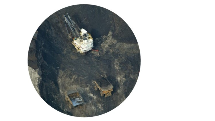
Oil sands
-
About monitoring in the oil sands region
Natural resource development has increased significantly in the oil sands region of northern Alberta, escalating the need to assess and understand the long-term cumulative effects of oil sands development on the environment. The Oil Sands Monitoring Program is a joint provincial and federal working partnership.