Overview
Highway 2 is a Level 1 highway, accommodating the movement of people, goods and services inter-provincially and internationally. Level 1 highways are defined as core routes in the National Highway System. When freeway standards become necessary, the frontage and local road network must transition to grade-separated access (for example, interchanges only) while maintaining access to the many businesses. See the resources section for the study location and study limits plans.
The current road network does not reflect the latest Highway 743 alignment and access management needs. A functional plan is required for Highway 2, complete with staging to address the various needs and requirements along the study corridor.
A functional planning study is the first step in understanding how the highway and connecting roads would need to be modified. Construction of the recommendations from this study are not on the provincial construction program.
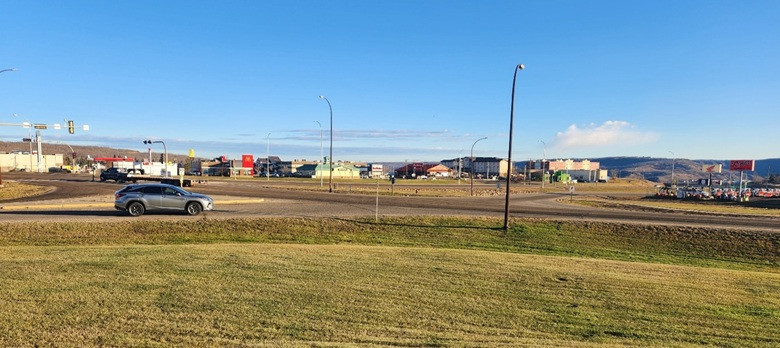
Intersection of Highway 2 and 78 Street, looking northeast.
Benefits
This functional planning study is anticipated to be complete in 2027. It will identify the most practical and feasible configuration to upgrade the corridor to freeway standards, while providing access to adjacent development. The functional plans will help guide growth and development in a manner that is consistent with a long-term corridor plan.
Timeline
-
Spring/Summer 2026
Stakeholder notifications and information gathering for technical investigations.
-
Summer/Fall 2026
Develop alternatives and complete technical analysis.
-
Fall 2026
Compare alternatives through preliminary evaluations, pre-screening and stakeholder and public engagement.
-
Winter 2026
Select preferred alternative through final evaluations
-
Winter/Spring 2027
Finalize preferred alternative by developing functional plan along with stakeholder and public engagement.
Conducting the study
CIMA Canada Inc. (CIMA+) is conducting the functional planning study, which will:
- assess conditions and constraints along the corridor
- include stakeholder and public engagement to identify the concerns and interests of potentially impacted property owners and highway users
- investigate feasible freeway and access management configurations
- develop a recommended highway plan that:
- provides the most appropriate long-term design given the existing conditions, constraints and highway design standards
- identifies the access management needs
- identifies and addresses, where possible, the impacts of proposed changes to the corridor, including land, environmental resources, utilities, drainage and others
- identifies a staged implementation plan to ensure the highway functions in a safe and efficient manner while supporting economic growth along the corridor (staging is subject to traffic growth, land development and government priorities)
Construction of the upgrading plans along Highway 2 based on the outcomes of this study is not on the provincial construction program. The need for and timing of the design stages leading to future construction will be determined following the completion of the functional plan.
Resources
The following maps show the study location and limits:
Contact
Connect with CIMA+ for more information:
Hours: 8:30 am to 4:30 pm (open Monday to Friday, closed statutory holidays)
René Rosvold, P.Eng., Project Manager, CIMA+
Phone: 403-775-0100, ext. 7620
Email: [email protected]