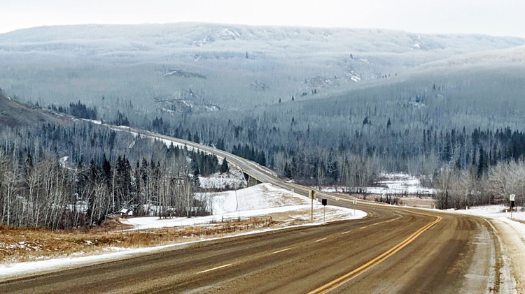
Highway 64, looking east across the Clear River Valley.
Overview
Highway 64 is a major 2-lane, inter-provincial highway and Alberta’s northernmost connection to the British Columbia border. A primary transportation corridor through Clear Hills County, Highway 64 links most of the county’s hamlets, and provides access to the Clear River Campground and Rodeo Grounds, local agricultural uses and resource activities.
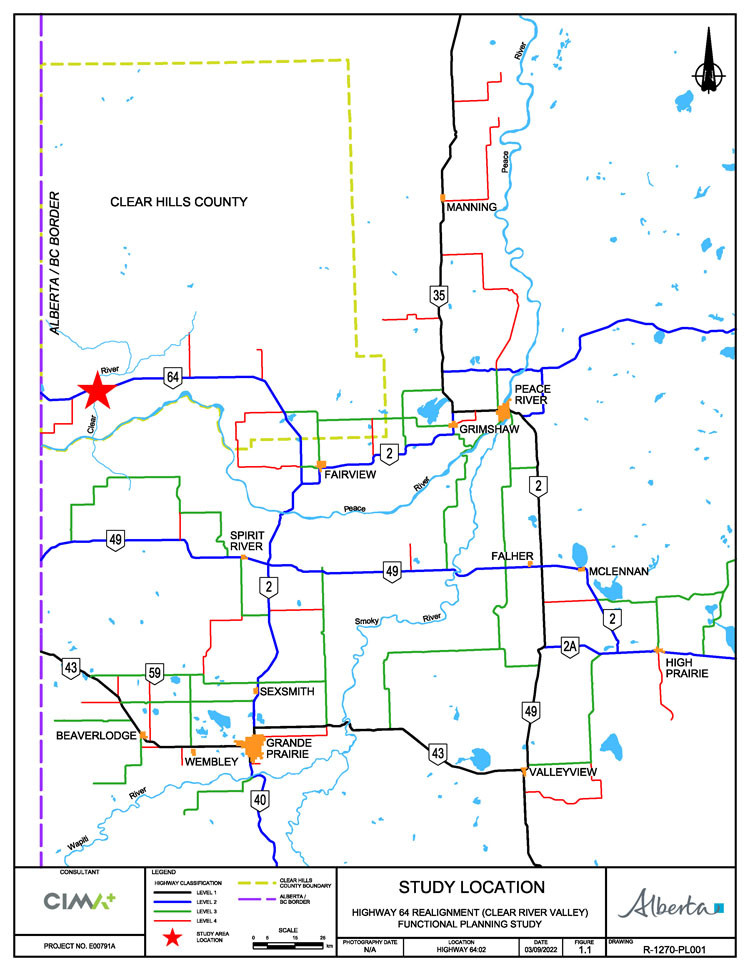
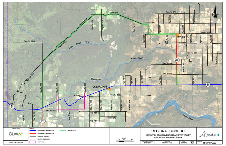
The existing section of Highway 64 through the Clear River Valley and crossing the river is increasingly at risk of major slides. We undertook a functional planning study to determine the most practical and feasible alignment for crossing the Clear River Valley. The following maps show the study location and limits:

A functional planning study is the first step in understanding the needs for any future highway upgrading. The study was initially focused on identifying a new alignment for Highway 64 through the Clear River Valley. Following the initial review of new alignment alternatives and considering the stakeholder feedback received to date, the study was expanded to include the existing crossing alignment.
Construction or reconstruction of a highway alignment through the Clear River Valley is not on the provincial construction program at this time. The need for further design leading to future construction will be determined based on the study outcomes.
The study:
- assessed conditions and constraints in the study area
- identified the concerns and interests of potentially impacted property owners within the study area
- assessed the reliability, stability, safety and costs of potential alignments
- evaluated improvements to the existing Highway 64 alignment and river crossing compared with a new alignment option across the valley
- developed an alignment plan that:
- provides the most appropriate design given the site constraints
- addresses stability and safety, community interests, environmental and historical resources, drainage and other impacts
- identifies access management needs
- identifies land requirements
Timeline
The Functional Planning study is now complete. Approved Functional Plans were developed based on technical assessments and feedback provided by stakeholders and the public during the various engagement sessions.
Benefits
The study identified the most feasible alignment for Highway 64 crossing the Clear River Valley.
Public engagement
Public information sessions and stakeholder meetings were held in Cleardale on November 23, 2022, and October 23, 2024.
Engagement materials can be found in the Resources section.
Resources
October 2024 Information Session materials:
November 2022 Information Session materials:
Contact
Connect with Alberta Transportation and Economic Corridors (Peace Region):
Phone: 780-624-6384
Toll free: dial 310-0000 before the number (in Alberta)
Email: [email protected]
Address:
9621 – 96 Avenue
Bag 900, Box 29
Peace River, Alberta T8S 1T4