Due to warm temperatures, the wildfire danger in the Slave Lake Forest Area has climbed to high. The warm weather has dried up the recent moisture and a fire will ignite easily and will spread rapidly. Firefighters urge everyone to use caution and prevent any new wildfires.
Wildfire situation
Yesterday, thunderstorms with lightning moved through the Slave Lake Forest Area. Fire lookout observers are watching for smoke and firefighters with aircraft are ready to respond to any new wildfires that may start.
There are currently 17 active wildfires in the Slave Lake Forest Area.
To view wildfires on a map visit the Alberta Wildfire Status Dashboard.
Since January 1, 2025, there have been 118 wildfires in the Slave Lake Forest Area, resulting in a total burned area of 382,595 hectares (ha).
Red Earth East Complex
The Red Earth East Complex includes 10 wildfires that are located east of Highway 88: SWF085, SWF089, SWF091, SWF092, SWF094, SWF095, SWF099, SWF100, SWF110 and SWF115.
The fire activity on all wildfires has been reduced due to recent rain. The rain helped prevent further spread but there is still active fire within the perimeter of the wildfires.
Winds from the east are expected today. Heavy equipment has been deployed to work on containment lines in areas where the wind could lead to increase fire activity. Firefighters are working on extinguishing hot spots along the containment lines.
SWF085, which impacted the community of Chipewyan Lake, is 13,7878 ha in size and is classified as out of control. Firefighters continue to monitor the wildfire from helicopters and will be working on areas that show increased fire activity.
SWF089 is located approximately 5.5 km east of Peerless Lakes. It is 12,435 ha in size and is classified as out of control. The area of the wildfire that is closest to Peerless Lake is a priority with winds from the east expected. Heavy equipment has completed containment lines around recently burned areas and is building additional containment line between the community of Peerless Lake and the wildfire.
SWF092 located approximately 7 km southeast of Red Earth Creek and 8.5 km west of Trout Lake is 76,878 ha in size and is classified as out of control. Hot spots within the interior of the wildfire on the west side were doused by helicopters with buckets. Heavy equipment have completed containment lines around a recently burned area on the southwest corner, to keep the wildfire from advancing towards Highway 88.
SWF095 located approximately 2 km from Peerless Lake and 7 km from Trout Lake is 1,271 ha in size and is classified as out of control. The wildfire remains within containment lines, which have been tied into the lakes. While there are still hot spots within the interior of the wildfire, no open flame was observed. Wildland Urban Interface (WUI) firefighters are maintaining the sprinkler systems around the community and in a buffer area between the wildfire and Peerless Lake.
SWF100 located approximately 5 km west of Peerless Lake is 16,832 ha in size and is classified as out of control. The wildfire has spread west along Highway 686. Firefighters, heavy equipment and helicopters with buckets, are focusing on limiting wildfire spread on the northwest side.
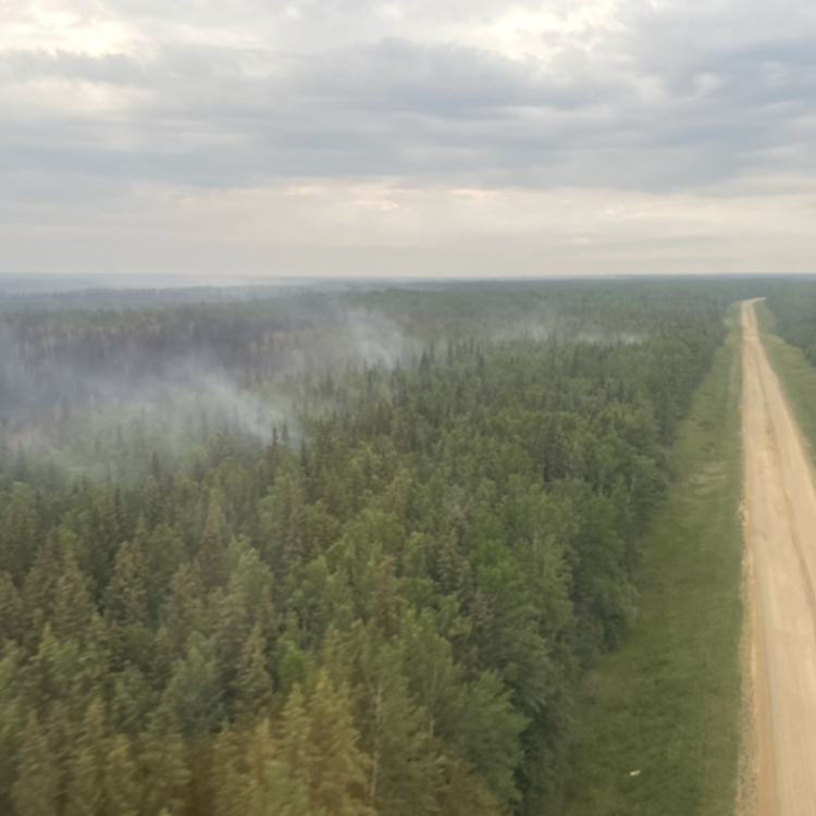 Highway 686 acts as a containment line to prevent wildfire SWF100 from spreading further to the west (June 17, 2025 at 9 pm).
Wildfires included in this complex that are not detailed above are not a threat to any communities.
Evacuation orders
Evacuation orders remain in effect for the following communities:
For information about the wildfires in the Red Earth East Wildfire Complex, contact Dan Troke at 780-843-5772 or [email protected]
Blue Sky and Edith Lake wildfires (SWF088 and SWF076)
Due to recent rain, the fire activity has been reduced and no open flame or smoke has been observed on the wildfire.
Firefighters supported by helicopters continue to look for and extinguish hot spots on the north and south sides of the wildfire.
An 8-hour evacuation alert remains in effect for the community of Marten Beach. For more information visit, Alberta Emergency Alert or the MD of Lesser Slave River website.
The Edith Lake Wildfire (SWF076) is located approximately 8 km north of Swan Hills. Thanks to the efforts of firefighters, heavy equipment and aircraft, this wildfire is classified as being held. It is 16,852 hectares in size.
No visible smoke has been observed on the wildfire. Heavy equipment is reclaiming containment lines on the far south side of the wildfire and firefighters continue to look for and extinguish hot spots.
Although the overall wildfire risk has decreased in some areas, some dangers remain. Residents and anyone in the area are encouraged to stay alert, take precautions and avoid the wildfire area.
Possible dangers include:
- Unstable trees that may fall without warning
- Hidden hot spots or ash pits
- Smouldering materials
- Displaced wildlife in the area
Please use caution when moving through the area and be advised that reduced speed limits are in place along Highway 33 to protect firefighters working in the area.
The evacuation alert has been lifted for the Town of Swan Hills. For more information, visit Alberta Emergency Alert or the Town of Swan Hill’s website.
For more information these wildfires, contact Sharma Chavez at 505-331-7421 or [email protected]
Fire ban lifted
The fire ban in the Slave Lake Forest Area was lifted on June 16.
Firefighters thank you for your cooperation and patience while the fire ban was in effect. Valid fire permits are now reinstated and new fire permits will be issued.
Fire permits are required
From now until October 31, fire permits are required for any burning, except campfires, in the Forest Protection Area of Alberta. Fire permits are free and are now available online. Visit Get a fire permit for information on how to make a request online.
Fire permits are also still available, by request, from your local Forestry Office.
- Wabasca 780-891-3860
- Slave Lake 780-849-7377
- High Prairie 780-523-6619
Choose a safe campfire site
When visiting campgrounds or recreational areas, use the designated stoves, fire rings or fire pits. These are designed to keep fires from spreading and are the best choice for a safe campfire. When outside of a campground, use sites that are clear of dry grass and vegetation. Clear the site down to bare mineral soil, place rocks in a ring, keep it sheltered from wind and always have water nearby to extinguish your campfire.
Never leave a campfire unattended. When you're done, always soak it, stir it and soak it again until the ashes are cool to the touch.
When riding your off-highway vehicle
Off-highway vehicles (OHVs) have exhaust systems that get hotter than 200°C. At these temperatures, built-up materials (such as grass, muskeg, moss, or other debris) can heat up, smoulder and ignite. These can fall to the ground as you are riding, starting a wildfire.
To help prevent wildfires when riding your OHV, stop frequently to remove any build- up of debris on your machine's muffler and always carry firefighting equipment such as a small shovel, collapsible pail or fire extinguisher.
Contact info
Leah Lovequist
780-849-0945
[email protected]
Published on June 18, 2025 1:52 pm