The fire danger level remains extreme throughout the High Level Forest Area (HLFA) due to hot, dry and windy conditions. With very little precipitation, grass, leaves and other vegetation are very dry in most areas, which could fuel a fast-moving wildfire that can quickly grow out of control. Please use caution if you are spending time or working outside — and avoid outdoor activities that have the potential to ignite a fire.
Wildfire situation
HWF036 - Sousa Creek Wildfire
Firefighters, aircraft and heavy equipment continue their suppression efforts on HWF036, which is currently out of control at an estimated 25,000 hectares (ha). This wildfire — at its western edge — remains about 31 km east of the Town of Rainbow Lake and is currently 73 km west of the Town of High Level and about 6.8 km from the southern edge of the community of Chateh, which has been fully evacuated except for emergency personnel.
This wildfire crossed to the north side of the Highway 58 in several places (near the Chateh turnoff) overnight, moving eastbound — adjacent to the highway — and burning into the western edge of the Basset fire of 2023. North of the highway, it continues east-northeast towards the previous fire boundary and the Chinchaga River.
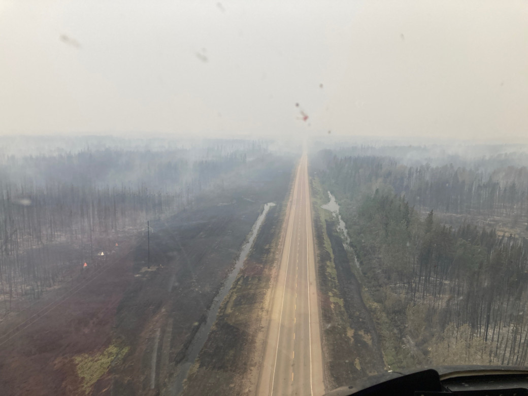 An aerial view of Highway 58 (facing west), south of the community of Chateh (May 31)
Fire crews and heavy equipment operators continue their efforts to build containment (guard) with a focus on the northern perimeters. Containment northwest of the highway at the Chateh turnoff has, so far, been successful and additional containment line is being built along the northern flank of the eastern portion of the fire (east of the Chateh turnoff) — between the wildfire and the community.
Operations will continue overnight as part of our ongoing efforts to protect people, communities, the highway and other infrastructure in the area. Structure protection (SP) efforts continue in the Chateh community with additional SP resources deployed from the Town of Rainbow Lake.
Travellers on Highway 58 should expect delays or intermittent closures (please check 511 for updates). The cause of this wildfire remains under investigation.
HWF037 west of TCFN South
This wildfire, which is approximately 33 km west of the western perimeter of Tall Cree First Nation (TCFN) South, is currently burning out of control at an estimated 940 ha. There was some growth overnight and into today; however, this slowed as the fire moved into areas to the northeast, which had previously burned in 2015.
Airtankers have conducted several retardant drops to this point and more suppression actions are planned once conditions permit. This will include the use of ground crews, heavy equipment and further air support. Some heavy equipment (dozer crews) is set to move into location this evening to begin work on containment lines overnight and tomorrow.
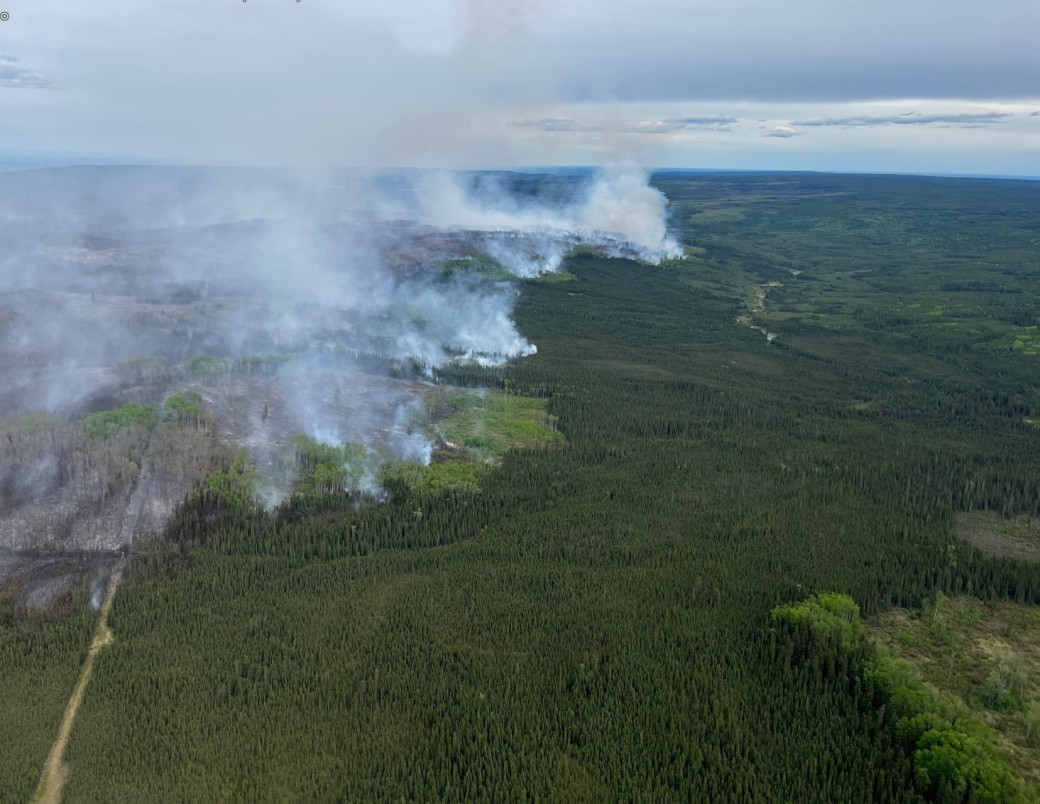 An aerial view of HWF037, which is currently about 33 km west of Tall Cree First Nation South, at about 3 pm on May 31.
HWF040 east of La Crete Ferry
Firefighters, aircraft and heavy equipment continue their suppression efforts on this wildfire, which is approximately 20 km east of the Tompkins Landing (La Crete) Ferry and 35 km east of Highway 35. This wildfire is currently out of control at an estimated 395 ha. There has been some growth to the northeast and this wildfire is now up against Highway 697.
Travellers on Highway 697 should expect delays or intermittent closures (please check 511 for updates).
The La Crete Fire Department is supporting Alberta Wildfire, providing structural protection for homes and other key infrastructure in the area. The Fort Vermilion Fire Department has also been providing support.
Smoke from wildfire on the Alberta-B.C. border
Residents and others on the western side of the HLFA may see smoke from a wildfire (HBZ001) currently burning along the provincial border. The HLFA Fire Centre is in regular contact with its B.C. counterpart to monitor this wildfire. The Government of Canada also monitors smoke conditions across the country.
In 2025, there have been 42 wildfires in the HLFA to date, burning more than 26,000 ha.
To view wildfires on a map and for live updates, download the Alberta Wildfire App or visit the Alberta Wildfire Dashboard. Learn more about wildfire status definitions used in Alberta.
Fire ban
A fire ban is now in effect throughout the entire High Level Forest Area. Under this ban, all outdoor wood fires are prohibited and existing fire permits are suspended.
Prohibited:
- All outdoor wood fires, including wood campfires on public and private land, designated firepits and backyard firepits
- Barbecue charcoal briquettes
- Fireworks and exploding targets
Allowed:
- Propane fire pits and natural gas-powered appliances
- Indoor wood fires
- Open flame oil devices
The fire ban will remain in place until conditions improve.
Visit Alberta Fire Bans to see the boundaries of the fire ban implemented on May 29, 2025.
Lightning-caused wildfires
Lightning-caused wildfires are a common natural occurrence in Alberta, accounting for approximately 30% of the wildfires that occur each year. These wildfires often start in remote areas when lightning strikes dry vegetation, such as grass and trees, which can facilitate a quick start. Since these starts are often located far from roads or communities, they can easily go unnoticed.
Alberta Wildfire closely monitors lightning activity using resources such as aerial surveillance and fire lookout observers to detect and respond to these wildfires as quickly as possible. Many fire detections are also reported by the public.
As an example, several of the very recent wildfires starts detected in the Slave Lake Forest Area have been determined to have been caused by lightning.
All forest areas have firefighters and equipment ready to respond. Please call 310-FIRE if you see smoke or flames and suspect it's a wildfire. Learn more about how to report a wildfire.
Contact info
Mark Giles
780-285-4490
[email protected]
Published on May 31, 2025 8:55 pm