The fire danger is now very high. A wildfire will ignite very easily in these conditions and can quickly grow out of control. High temperatures and low humidity will cause intense fire behavior. Strong winds are forecasted in the coming days, a wildfire could move quickly under those conditions. View our fire danger maps online.
Avoid all outdoor activities that have the potential to cause a fire from a spark, friction or hot exhaust.
Call 310-FIRE if you see smoke or flames and suspect it's a wildfire. Learn more about how to report a wildfire.
Wildfire situation
Since January 1, there have been 41 wildfires in the Edson Forest Area burning a total of 1,085 hectares (ha). View active wildfires, their locations and statistics on the interactive map on our wildfire status page.
 EWF041 was 0.2 ha in size and now extinguished thanks to the quick response of firefighters last night (June 4, 2025 at 9:00 p.m.)
EWF038 near Cynthia
EWF038 is located 12 km northeast of Cynthia and 10 km east of Highway 753. It is 7 km north of Highway 621, on the northeast corner of Sink Hole Lake. The wildfire is estimated to be 10 ha and classified as under control which means that the wildfire has received sufficient suppression action to ensure no further spread. Firefighters continue searching for and extinguishing hotspots.
Yellowhead Wildfire Complex | EWF030, EWF036
January Creek Wildfire - EWF036
EWF036 is located on the south side of Peers. The size is now estimated to be 738 ha and remains classified as out of control which means that the wildfire has the potential to grow. A status change will only occur when firefighters are confident there is no risk for further growth. The cause of the wildfire is under investigation.
In order to allow residents to return to their homes, firefighters focused on the areas of the wildfire closest to the community. They built containment lines with heavy equipment on the north side of the wildfire. Firefighters searched for and extinguished hot spots in these areas to prevent any flare ups near Peers.
Firefighters from Alberta Wildfire, Yellowhead County Fire Department (YCFD), Oregon and Washington State Department of Natural Resources are working on this wildfire. They continue to work along and within the perimeter, securing and re-enforcing the containment lines surrounding the wildfire. This process, called mop up, can take several days and sometimes weeks, depending on how many hot spots are found and how deeply they are burning in the ground. The YCFD has begun removing some of the structure protection equipment for maintenance. The equipment will be redeployed if necessary.
Moderate fire behaviour was observed today. Flames were visible as the day warmed up. Firefighters will be on scene and ready to respond if an increase in fire behaviour does occur. Significant smoke may be visible from within the fire perimeter.
Mercoal Creek Wildfire - EWF030
EWF030 is located 6 km west of Mercoal and 16 km southwest of Robb. The wildfire is now classified as being held which means that given current weather conditions and resources, the wildfire is not anticipated to grow past existing boundaries. The wildfire is estimated to be 320 ha in size and determined to be caused by lightning.
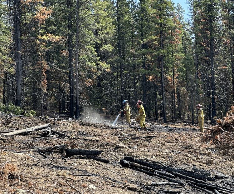
Multiple days of cool temperatures, higher relative humidity and some precipitation kept the fire activity low on this wildfire, allowing great progress to be made. Firefighters continue extinguishing hot spots, which involves digging deep into the ground and dousing the smouldering fire with water. They'll continue this work until the hot spots are extinguished.
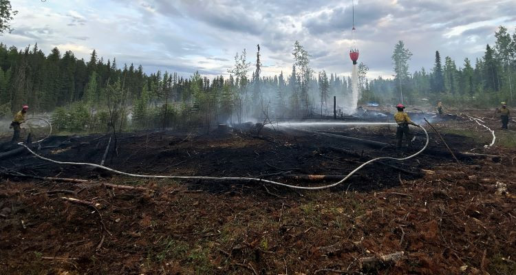
 Firefighters continue digging hot spots in the ground and extinguishing them with water on EWF030 (June 4, 2025)
Evacuations and road closures
Visit Alberta Emergency Alert or download the app for information on current evacuation orders or alerts. You can also find information on wildfire preparedness on our website. For highway closures, visit Alberta 511.
Safety near burnt areas
We urge residents and members of the public to use extra caution near burnt areas. There are many hazards that may not be visible, like deep burning ash pits and falling trees. Burnt trees are a serious hazard, and trees that may look healthy that have green needles or leaves could have burnt out roots under the ground and fall unexpectedly. Keep in mind that trees and powerlines could also fall on the road and block your vehicle. Do not approach powerlines as they could be energized.
Illegal use of drones near wildfires
Flying a drone near or over a wildfire endangers our pilots and forces us to ground aircraft, causing delays in firefighting operations. You could face a hefty fine for putting aircraft and people at risk. Please give our firefighters the space they need to do their jobs safely.
Fire ban
A fire ban is in effect for the entire Forest Protection Area in Alberta. Under this ban, all outdoor wood fires are prohibited and existing fire permits are suspended.
Prohibited:
- All outdoor wood fires, including wood campfires on public and private land, designated firepits and backyard firepits
- Barbecue charcoal briquettes
- Fireworks and exploding targets
Allowed:
- Propane fire pits and natural gas-powered appliances
- Indoor wood fires
- Open flame oil devices
The fire ban will remain in effect until conditions improve. Visit Alberta Fire Bans for more information and to see the boundaries.
Contact info
Caroline Charbonneau
780-740-1341
[email protected]
Published on June 5, 2025 7:34 pm