The wildfire danger is moderate across the Slave Lake Forest Area.
Scattered thunderstorms with lightning are in the forecast. These storms will bring varying amounts of rain, but warm, dry weather is expected to return for the weekend. The wildfire danger is expected to climb as the moisture will dry up quickly with only a few hours of warm temperatures.
Firefighters are urging everyone to do their part to prevent wildfires. Please be cautious with campfires, off-highway vehicles and any activity that could spark a fire.
With expected lightning, fire lookout observers are watching for smoke and firefighters supported by helicopters and airtankers are ready to respond to any new wildfires that may start.
There are currently 13 active wildfires in the Slave Lake Forest Area.
To view wildfires on a map visit the Alberta Wildfire Status Dashboard.
Since January 1, 2025, there have been 119 wildfires in the Slave Lake Forest Area, resulting in a total burned area of 385,246 hectares (ha).
Red Earth East Complex
The Red Earth East Complex includes 10 wildfires that are located east of Highway 88: SWF085, SWF089, SWF091, SWF092, SWF094, SWF095, SWF099, SWF100, SWF110 and SWF115.
View the latest map of the Red Earth East complex.
Firefighters, helicopters and heavy equipment continue to make good progress extinguishing hot spots on these wildfires. Due to today's warm and windy conditions, increased smoke was visible on these wildfires. Helicopters with buckets were deployed to cool areas of increased fire activity.
In the northern portion of the Slave Lake Forest Area, scattered showers are expected tomorrow and over the next few days. This rain will help reduce fire activity, creating more favorable conditions for firefighting efforts.
SWF085 which impacted the community of Chipewyan Lake, is 138,057 ha in size and is classified as out of control. The wildfire experienced a small amount of spread on the south side. Firefighters in a helicopter continue to monitor the wildfire and work on extinguishing hot spots.
SWF089 is located approximately 5.5 km east of Peerless Lakes. It is 12,961 ha in size and is classified as out of control. Heavy equipment continues to build containment line between the wildfire and the community of Peerless Lake. Firefighters are making good progress extinguishing hot spots on the southwest side of the wildfire.
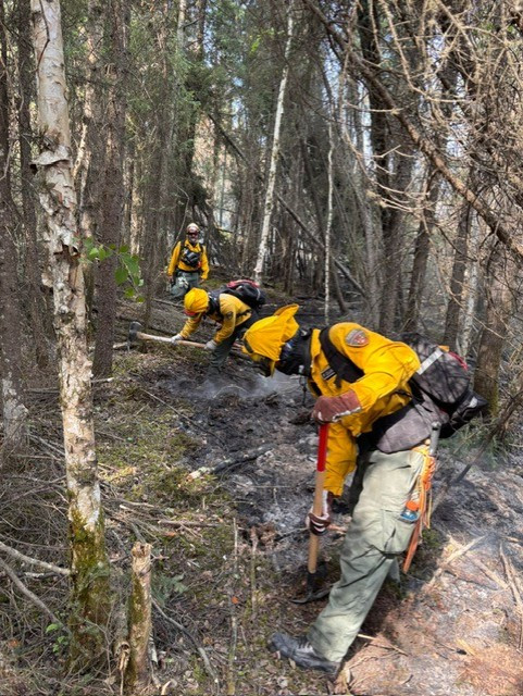 Firefighters from Costa Rica working on extinguishing hot spots on SWF092. June 23, 2025.
SWF092 located approximately 7 km southeast of Red Earth Creek and 8.5 km west of Trout Lake is 77,987 ha in size and is classified as out of control. Firefighters continue to extinguish hot spots along the containment lines on the northwest side of the wildfire, closest to the communities of Red Earth Creek and Loon Lake. In the afternoon, fire activity increased on the south side of the wildfire. Helicopter with buckets were deployed to knock down the open flames.
SWF095 located approximately 5 km from Peerless Lake and 7 km from Trout Lake is 1,328 ha in size and is classified as out of control. The wildfire remains within containment lines, which have been tied into the lakes. Wildland Urban Interface (WUI) crews test pumps and sprinkler set-ups each day in the communities of Peerless Lake and Trout Lake. Firefighters continue to work on extinguishing hot spots on the southwest side of the wildfire.
SWF100 located approximately 5 km west of Peerless Lake is 17,309 ha in size and is classified as out of control. Firefighters have been observing very little visible smoke across the wildfire. Heavy equipment continues to build the containment line along Highway 686 and is working on improving the condition of the highway.
The wildfires included in this complex that are not detailed above are not currently considered a threat to any communities.
Evacuation orders remain in effect for the following communities:
Residents of Red Earth Creek and Loon Lake will be allowed to return home starting June 25, 2025.
For details regarding re-entry please visit:
Although the overall wildfire risk has decreased, some hazards remain. Residents and anyone in the area are encouraged to stay alert, take precautions and avoid the wildfire area when returning to the community.
Possible dangers include:
- Unstable trees that may fall without warning
- Hidden hot spots or ash pits
- Smouldering materials
- Displaced wildlife in the area
Residents are also asked not to fly drones near the wildfires. Doing so is extremely dangerous because it forces firefighting aircraft to stop their operations, delaying critical efforts and putting firefighters and communities at risk. Flying a drone near a wildfire is illegal in Alberta and can lead to fines of up to $15,000. Please help keep our skies clear and support our firefighters by keeping all drones away from wildfire areas.
For information about the wildfires in the Red Earth East Wildfire Complex, please email [email protected]
Blue Sky and Edith Lake wildfires (SWF088 and SWF076)
The Blue Sky Wildfire (SWF088) located 22 km north of Marten Beach is 13,684 hectares in size and is classified as out of control.
A recent infrared scan of SWF088 detected multiple hot spots on the northwest, east and south sides of the wildfire. Firefighters, supported by heavy equipment and helicopters, are actively working to extinguish the identified hot spots.
View the latest map of the Blue Sky wildfire.
The Edith Lake wildfire (SWF076) located approximately 8 km north of Swan Hills is 16,852 hectares in size. Thanks to the hard work of firefighters, aircraft and heavy equipment operators, SWF076 is under control. Firefighters continue to patrol for hot spots with the interior of the wildfire and heavy equipment continues to reclaim containment lines.
View the latest map of the Edith Lake wildfire.
For more information these wildfires, contact Sharma Chavez at 505-331-7421 or [email protected]
Fire permits are required
From now until October 31, fire permits are required for any burning, except campfires, in the Forest Protection Area of Alberta. Fire permits are free and are now available online. Visit Get a fire permit for information on how to make a request online.
Fire permits are also still available, by request, from your local Forestry Office.
- Wabasca 780-891-3860
- Slave Lake 780-849-7377
- High Prairie 780-523-6619
Choose a safe campfire site
When visiting campgrounds or recreational areas, use the designated stoves, fire rings or fire pits. These are designed to keep fires from spreading and are the best choice for a safe campfire. When outside of a campground, use sites that are clear of dry grass and vegetation. Clear the site down to bare mineral soil, place rocks in a ring, keep it sheltered from wind and always have water nearby to extinguish your campfire.
Never leave a campfire unattended. When you're done, always soak it, stir it and soak it again until the ashes are cool to the touch.
When riding your off-highway vehicle
Off-highway vehicles (OHVs) have exhaust systems that get hotter than 200°C. At these temperatures, built-up materials (such as grass, muskeg, moss or other debris) can heat up, smoulder and ignite. These can fall to the ground as you are riding, starting a wildfire.
To help prevent wildfires when riding your OHV, stop frequently to remove any build- up of debris on your machine's muffler and always carry firefighting equipment such as a small shovel, collapsible pail or fire extinguisher.
Contact info
Leah Lovequist
780-849-0945
[email protected]
Published on June 24, 2025 5:55 pm