Due to warmer and windy conditions, the fire danger level in the High Level Forest Area (HLFA) remains high.
This high wildfire danger level applies primarily to the southern half of the HLFA, essentially south of Zama Road. This includes the areas around Rainbow Lake, Chateh, the Town of High Level, and the communities of Tall Cree First Nation and the Little Red River Cree Nation. The danger level for the northern half of the HLFA is currently assessed as moderate.
Wildfire situation
In 2025, there have been 23 wildfires in the HLFA to date, burning approx. 60 hectares (ha).
HWF020
This wildfire, which is located approximately 40 km southwest of the Town of High Level and is estimated to be 55 ha in size, is now being held. Firefighters, along with helicopters and other resources, continue their efforts to fully contain and control this wildfire, which poses no threat to communities at this time.
To view wildfires on a map and for live updates, download the AB Wildfire App or visit the Alberta Wildfire Status Dashboard. Learn more about wildfire status definitions used in Alberta.
Fire advisory
A fire advisory is in effect for the High Level Forest Area.
Under this advisory:
- Existing fire permits will remain valid, but extension requests may not be granted.
- New fire permits will be issued on a case-by-case basis.
- The burning of heavy fuels, including machine-piled brush piles and windrows is restricted.
- The fire advisory will remain in effect until conditions improve.
To learn more, visit Alberta Fire Bans.
Hazard-reduction burns
Forest officers, supported by firefighters and other resources – working closely with local authorities and fire departments – are conducting hazard-reduction burns (HRB) in the communities of Chateh and Tall Cree First Nation this week. These controlled HRB, which are conducted under close supervision, are aimed at reducing the amount of dry – and potentially very flammable – vegetation around communities and specific facilities and areas.
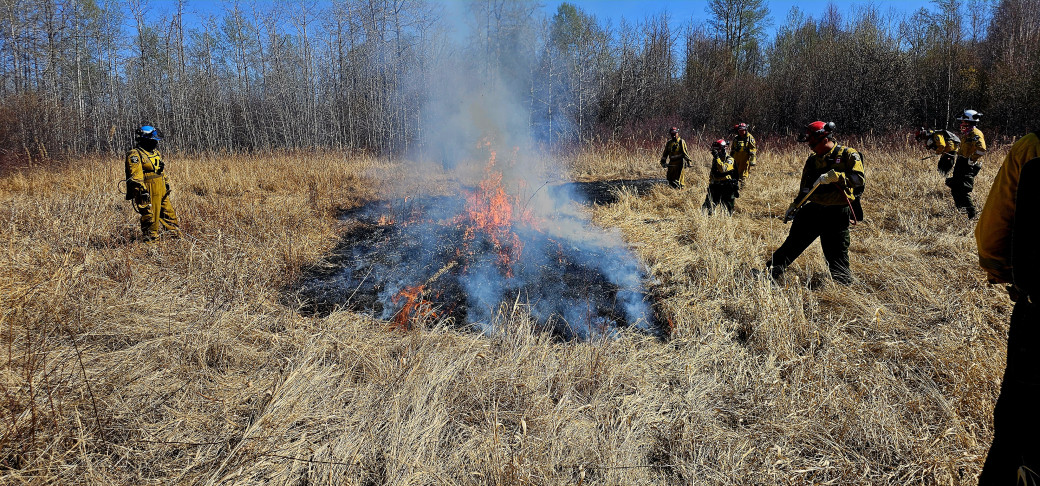 Firefighters from the HLFA burn a specific area, as part of a larger controlled HRB, in the Chateh area on May 7.
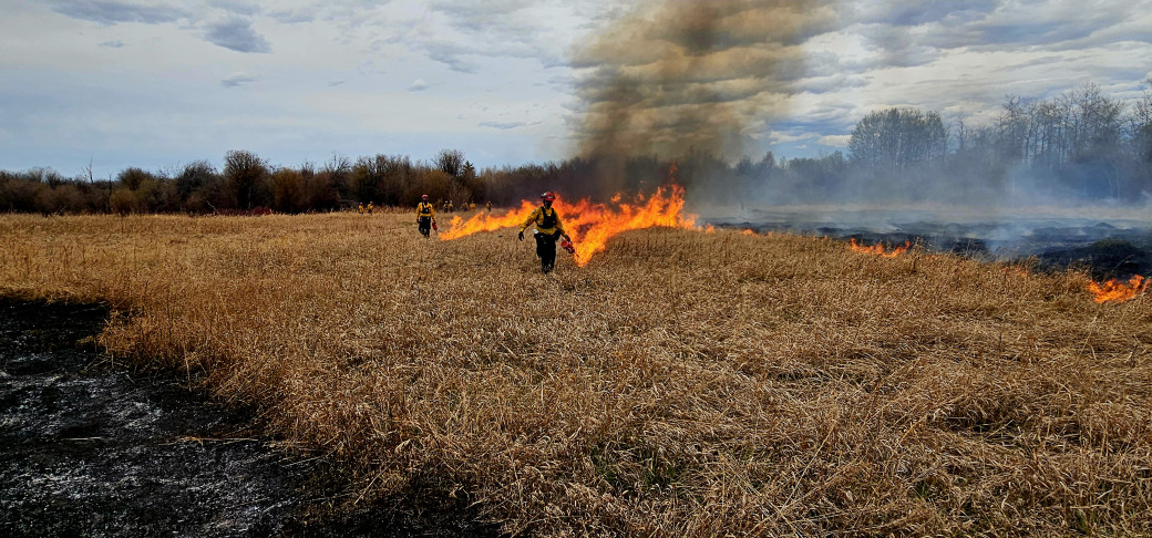 Firefighters initiate the burn of another section (within a designated area) during an HRB in the Chateh area, May 7.
Fire permits required
As we are now in the official wildfire season (Mar. 1 to Oct. 31), fire permits are required for any burning, except campfires, in the Forest Protection Area of Alberta. Fire permits are free and can be requested from the HLFA main office at 780-926-5407 or online.
Under the current fire advisory, existing fire permits will remain valid, but extension requests may not be granted. New fire permits will be issued on a case-by-case basis.
Spring conditions
As snow melts, and forest and other areas dry out, the risk of a wildfire igniting in dry grass and vegetation like twigs, small branches and brush, increases. Keep a close watch of your surroundings when working and recreating outdoors – and consider applying FireSmart techniques around your home and property.
Forest and Emergency Preparedness Weeks
Alberta recognizes the importance of conservation and stewardship of our trees and forests throughout the year; however, during Forest Week (May 4-10), we focus on the importance of this large part of our environment and our world.
This week is also Emergency Preparedness Week, which highlights to importance of being prepared year-round for a range of possible situations that may require specific actions by Albertans, including emergency responders and agencies; community leaders, residents and workers; and other organizations. Be prepared, know your risks.
Contact info
Mark Giles
780-285-4490
[email protected]
Published on May 7, 2025 10:55 am