The fire danger remains extreme. With very little rain in the forecast for the next few days, forest vegetation is dry and continues to pose a serious fire risk.
Wildfire situation
Wildfire south of Meander, west of Highway 35
HWF065, which is currently out of control, remains about 15 km south (from the reserve boundary) of the community of Meander River and about 2.2 km from Highway 35, at its closest point. It is currently estimated at 650 hectares (ha). This new estimate does not represent any significant growth in recent days and the perimeter remains the same. An aerial assessment of the fire was conducted over the weekend, resulting in a more accurate size.
Firefighters, heavy equipment and bucketing helicopters continue their efforts to contain and suppress this wildfire. The cause of HWF065 is under investigation. It does not currently pose a threat to communities.
Sousa Creek Complex
Wildfires HWF036, HBZ001 and HBZ002 have been combined to form the Sousa Creek Complex and are being managed together.
Wildfire HWF036 is between Rainbow Lake and High Level, on both sides of Highway 58. It is currently out of control at 53,295 ha.
The wildfire has not grown in several days and remains the same distance from the communities of Chateh, Rainbow Lake, Meander and High Level. Fire activity increased today with the return of hot and dry conditions. Smoke may be visible as unburnt pockets of vegetation ignite in the interior of the fire.
Firefighters continue to strengthen the containment line on the northern side of the perimeter, which is the closest to Chateh. They are working further into the interior of the fire, looking for and extinguishing hot spots. Firefighters, bucketing helicopters and heavy equipment are also working on containing the west and south sides of the wildfire.
Wildfires HBZ001 and HBZ002 are located on the Alberta-B.C. border. They are both out of control at 15,313 ha and 1,733 ha respectively. These wildfires have not grown recently. Firefighters are assessing them and responding as required.
None of the wildfires in the Sousa Creek Complex pose a threat to communities.
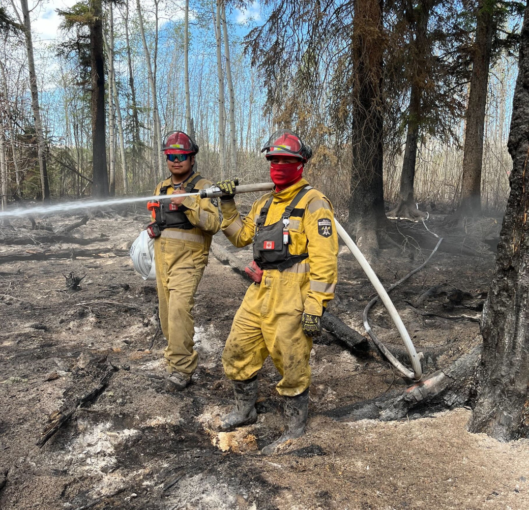 Firefighters extinguish a hot spot along the northern side of HWF036 (June 29).
Additional information for residents of Chateh and Meander
Public safety-related information may also be available on the Dene Tha Facebook page, Dene Tha Radio (89.9 FM), and posters in the Bushe and Meander communities (band offices).
Wildfire statistics
Since January 1, there have been 76 wildfires in the High Level Forest Area, burning more than 55,543 ha. To view wildfires on a map and for live updates, download the Alberta Wildfire App or visit the Alberta Wildfire Status Dashboard. Learn about the wildfire status definitions used in Alberta.
Fire ban
A fire ban remains in effect for the High Level Forest Area. Under this ban, all outdoor wood fires are prohibited, and existing fire permits are suspended.
Prohibited:
- All outdoor wood fires, including wood campfires on public and private land, designated firepits and backyard firepits
- Barbecue charcoal briquettes
- Fireworks and exploding targets
Allowed:
- Propane fire pits and natural gas-powered appliances
- Indoor wood fires
- Open flame oil devices
The fire ban will remain in effect until conditions improve. Visit Alberta Fire Bans for more information and to see the boundaries. See the fire ban fact sheet for more information.
Community engagement
The High Level Forest Area will be participating in several community outreach events over the next few weeks, including:
- Canada Day celebrations in the Town of High Level – Tuesday, July 1
- High Level Rodeo - Saturday/Sunday, July 12-13
Alberta Forestry's mascot, Bertie Beaver, is expected to make appearances on Canada Day and at the rodeo.
Contact info
Mark Giles
780-285-4490
[email protected]
Published on June 30, 2025 3:26 pm