The fire danger remains extreme. Forest vegetation is extremely dry and poses a very serious fire risk. Fast-spreading, high-intensity fires are possible, which can make firefighting challenging.
We urge residents, members of the public and industry to use extreme caution until conditions improve. Plan any activities that could create a spark, hot exhaust or friction late in the evening or early in the morning. Keep watch of your surroundings and carry sufficient firefighting equipment and water if you are working outdoors.
Wildfire situation
Sousa Creek Wildfire (HWF036)
The Sousa Creek Wildfire is located between Rainbow Lake and High Level, near the Chateh turnoff, and along both sides of Highway 58. This wildfire, which remains out of control, is estimated to cover an area of more than 41,000 hectares (ha). The cause of this wildfire remains under investigation.
The wildfire remains approximately 5.3 km from the southern edge of the community (reserve area) of Chateh, 55 km from the southeast edge of the community (reserve area) of Meander River, 71 km from the western edge of the Town of High Level and 27 km from the eastern edge of the Town of Rainbow Lake.
Firefighters are continuing their work along and within the perimeter — with a focus on the north and northeast sides — securing and re-enforcing the containment lines surrounding the wildfire, while working closely with heavy equipment and helicopters with water buckets. This can be a long and labour-intensive process, depending on how many hot spots are found and how deeply they are burning into the ground.
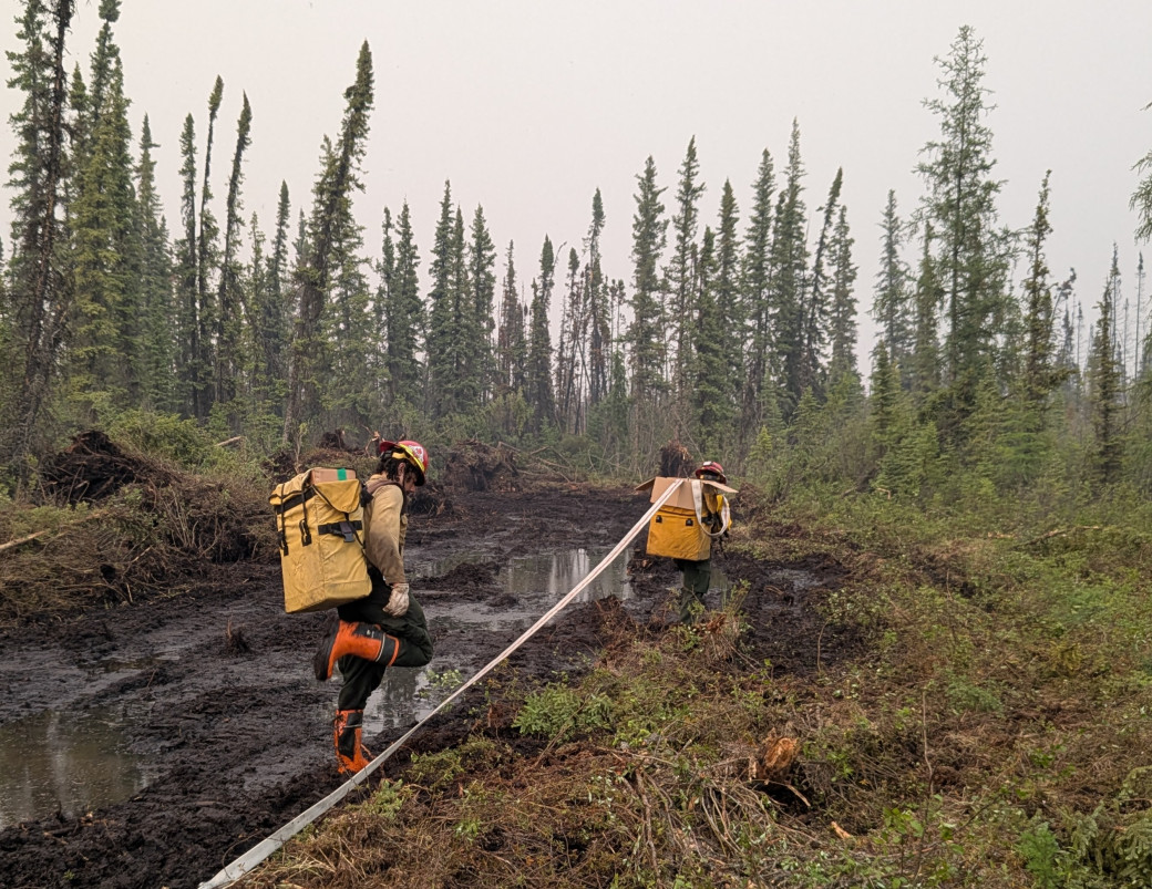 Firefighters with hose search for — and suppress — hot spots on the Sousa Creek Wildfire (June 10)
Firefighters, including an additional U.S. fire crew that arrived over the past 48 hours, are ready to respond if an increase in fire activity occurs. Airtankers conducted preventative retardant drops on the west side of HWF036 yesterday. The incident management team continuously assesses conditions and will request additional airtanker drops, if required. Night-vision-equipped helicopters are also being employed on HWF036, when available and when conditions (primarily visibility) permit, to assist with overnight operations.
Alberta Wildfire continues to work closely with the Chateh Fire Department to coordinate and maintain structure protection in and around the community. Power to the Town of Rainbow Lake and Chateh is not currently impacted. ATCO crews continue to work on repairing damaged powerline infrastructure within the fire.
Posted speed and highway closures
Firefighters are asking members of the public to slow down near work areas. Please respect the 50 km/h signs for everyone’s safety. Expect delays or intermittent closures on Highway 58 — visit Alberta 511 for updates.
HWF037
This wildfire, which is within the Buffalo Head Hills, about 33 km west of the community of Tall Cree First Nation South, is being held at approximately 1,060 ha.
Firefighters supported by helicopters continue making good progress building containment lines and searching for and extinguishing hot spots. An aerial scan is set to be conducted on this wildfire on Thursday, which should provide additional information and support planning for ongoing operations. There is currently no threat to communities, and its cause is under investigation.
Smoke from wildfires on the Alberta-B.C. border
Residents and others on the western side of the forest area may see smoke from three wildfires (HBZ001, HBZ002 and HBZ003) currently burning along the provincial border. The High Level Fire Centre is in regular contact with its B.C. counterpart to monitor these wildfires. The Government of Canada also monitors smoke conditions across the country.
Visit Fire Smoke Canada to see where smoke is coming from. If you have smoke-related health concerns, call 811 or visit the Alberta Health.
Wildfire statistics
Since January 1, there have been 50 wildfires in the High Level Forest Area, burning a total of 42,798 hectares (ha). To view wildfires on a map and for live updates, download the Alberta Wildfire App or visit the Alberta Wildfire Dashboard. Learn more about wildfire status definitions used in Alberta.
Responding to new wildfires
The forest area has firefighters, helicopters and heavy equipment ready to respond to new wildfire starts. Call 310-FIRE if you see smoke or flames and suspect it's a wildfire. Learn more about how to report a wildfire — the sooner you report it, the quicker our fire crews can respond.
Fire ban
A fire ban is in effect for the entire Forest Protection Area in Alberta. Under this ban, all outdoor wood fires are prohibited and existing fire permits are suspended.
Prohibited:
- All outdoor wood fires, including wood campfires on public and private land, designated firepits and backyard firepits
- Barbecue charcoal briquettes
- Fireworks and exploding targets
Allowed:
- Propane fire pits and natural gas-powered appliances
- Indoor wood fires
- Open flame oil devices
The fire ban will remain in effect until conditions improve. Visit Alberta Fire Bans for more information and to see the boundaries. See the fire ban fact sheet for more information.
Contact info
Mark Giles
780-285-4490
[email protected]
Published on June 11, 2025 2:38 pm