History
Forest inventories are the basis for the management of Alberta’s forest resources. Since 1949, 4 major forest inventories have been completed:
- Phase 1: Broad Scale Forest Inventory
- Phase 2: Detailed Forest Inventory
- Phase 3 Forest Inventory
- Alberta Vegetation Inventory (AVI)
Phase 1: Broad Scale Forest Inventory
During and shortly after the Second World War, the demand for lumber and wood products increased dramatically. This resulted in concern over the lack of knowledge about the extent of the provincial forest resource and led to fears that the timber supply could be easily depleted. The Broad Scale Inventory, or Phase 1, was initiated in 1949 in response to these concerns. The inventory served as the information base to plan the management of Alberta’s forest resource.
The Phase 1 Inventory included all publicly owned forested lands in the province, except for Indigenous lands, national parks and an area known as the Rocky Mountain Forest Reserve. Through the use of aerial photo interpretation, the land was classified broadly into productive, potentially productive or non-productive.
Phase 1 was used to define areas suitable for agriculture, to determine timber harvest levels and to plan forest protection and timber and industrial development. After the inventory was completed, no attempts were made to keep the information current. This map series is available for download from Open Data Alberta as a series of 1:50,000 NTS mapsheets.
Phase 2: Detailed Forest
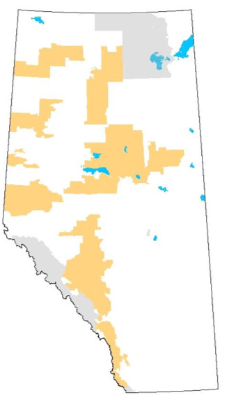
The Detailed Inventory, or Phase 2, started in 1956 and finished in 1966. The major objectives were to complete an inventory of areas not covered under Phase 1, particularly those areas with stands of timber suitable for lumber production. The data was also used for annual allowable calculations on Forest Management Units (FMUs) where timber quotas were to be issued.
Between 1965 and 1967, the Detailed forest inventory was supplemented by a major project called the Quota Reconnaissance Survey. The project was designed to meet increasing demands for timber supplies by selecting areas suitable for the establishment of new quotas. The Quota Reconnaissance Survey focused on merchantable stands and logging possibilities and was used as the basis for quota planning. Maps were produced at scales of 1:31,680 and 1:40,000 and indicated species composition, stand density and height.
The Phase 2 inventory included the following three different types of inventory:
- Detailed forest inventory – 403 map sheets, four townships per map sheet at a scale of 1:31,680
- Detailed forest inventory (eastern slopes) – 668 map sheets, one township per map sheet at a scale of 1:15,840
- Quota Reconnaissance Survey – 139 map sheets, four townships per map sheet at a scale of 1:31,680
The Phase 2 map series is available for download from Open Data Alberta.
Phase 3
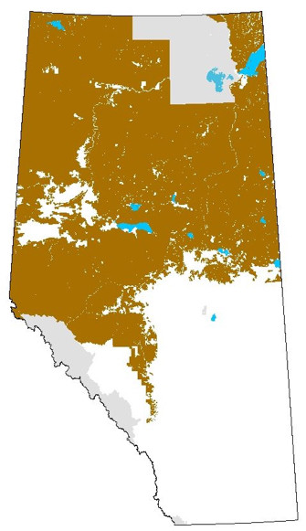
The Phase 3 Forest Inventory program was initiated in 1970. By 1986, blanket coverage of the Green Area and fringe areas was completed except for 3 forest management units in the northern area (A13, F10, and F20), the Cold Lake Air Weapons Range (L9), Federal Indian Reserves and the Wilderness Areas within the province. A comprehensive update program provided users with the most current information.
In 2003, the approximately 4,400 Phase 3 Inventory township mylars were scanned into both PDF and TIFF formats. They are available on Open Data Alberta, organized by meridian.
The Phase 3 inventory was officially retired in March 2007 and was replaced by the AVI standard.
The final March 2007 Phase 3 Data Summary consists of 4,353 unique townships/map sheets, covering 39,041,955.8 ha or approximately 59% of the Province of Alberta
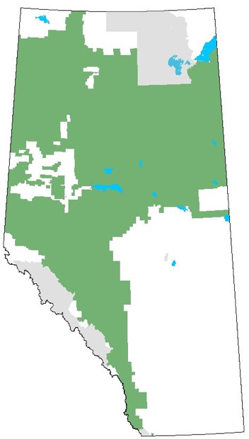
Alberta Vegetation Inventory (AVI)
The reasons behind the impetus for a new forest inventory in Alberta starting in the mid-1980s include:
- increasing forest industry development
- improving technology (hardware and software)
- rapidly changing forest management objectives and constraints
Previous forest inventories, such as the Phase 2 and Phase 3 inventories, were considered to be heavily biased towards coniferous forests. So one of the objectives for the new inventory was to create a detailed, flexible inventory useful for many applications.
The first specifications – the White Area Forest Inventory – for an integrated vegetation inventory were drafted in 1987 and field tested the same year. These initial standards borrowed heavily from Phase 3 with similar attributes and codes. The standards were revised in February 1989. The result was AVI Version 1.0.
In November 1990, the Vegetation Information Steering Committee agreed to an enhanced version of the AVI specifications as the minimum standard for inventorying accessible forest lands. This new inventory standard was referred to as the Collective Vegetation Inventory (CVI). Subsequently, the name of the inventory standard was changed to Alberta Vegetation Inventory Version 2.0 to reduce user confusion.
The Alberta Vegetation Inventory Standards Version 2.1 was released in November 1991. Major changes included dropping references to ‘productive’ and ‘non-productive’ forest land, changing the term ‘Site Index’ to ‘Timber Productivity Rating’, adding additional Field Check types, dropping ‘Photo Interpretation and Base Map Procedures and Specifications’ as well as ‘Standards’ (audit) from the manual.
The Alberta Vegetation Inventory Standards Version 2.1.1 was approved by the former ministry of Sustainable Resource Development in September 2007. This information is available on Open Data Alberta.
Since 2007, there have been significant changes in technology for AVI acquisition. The latest version of the AVI Standards, Version 2.1.5:
- consolidates all existing components into one document
- removes or updates antiquated methodology specifications
- documents requirements that are standard practice today but were never part of the AVI 2.1.1 standards
- incorporate detail regarding the AVI audit procedures
Current standards
Alberta Vegetation Inventory Standards: Version 2.1.5 (January 2022)
The current standards cover:
- Introduction
- Background
- AVI Plans
- Interpretation Standards
- Specifications
- AVI Audit Procedures
- Standards and Specifications for Capturing Timber Harvesting Activities
AVI Tools
Other resources
- Alberta Vegetation Inventory (Crown): An aerial imagery-based inventory that has been developed to spatially identify the type, extent and condition of forest vegetation. This dataset consolidates all the AVI from Crown-managed (non-forest management agreement) Forest Management Units into a single feature class and is available to the public.
- Primary Land and Vegetation Inventory (PLVI) : An imagery-based digital inventory developed to identify the type, extent and conditions of vegetation in the forested and parkland areas of the province of Alberta. This includes portions of both the Green and White areas of the province. It will include areas of the province extending north from the extent of the Grassland Vegetation Inventory (GVI) and will include areas where the detail and expense of Alberta Vegetation Inventory (AVI) are not warranted. This dataset is available to the public.
- Grassland Vegetation Inventory (GVI): Represents the Government of Alberta's comprehensive biophysical, anthropogenic and land-use inventory of the southernmost portion of the province's White Area. This dataset is available to the public.
- Derived Ecosite Phase (DEP): Digital and spatial representation of ecological sites and phases in areas of Alberta where there is both AVI and lidar coverage (mainly in the Green Area). This dataset is available to the public.