The fire danger level remains extreme throughout the High Level Forest Area.
Wildfire situation
Sousa Creek Wildfire (HWF036)
The Sousa Creek Wildfire is between the towns of Rainbow Lake and High Level, near the Chateh turnoff, and along both sides of Highway 58. This wildfire, which is out of control at an estimated 37,000 hectares (ha), remains the highest priority fire within the forest area.
It is located (approximately):
- 5.3 km from the southern edge of the community (reserve area) of Chateh
- 55 km from the southeast edge of the community (reserve area) of Meander River
- 71.5 km from the western edge of the Town of High Level
- 27 km from the eastern edge of the Town of Rainbow Lake
Today, the fire saw very minimal growth, and fire crews and bucketing helicopters again focused on the north-northeast perimeter as part of overall efforts to protect the community of Chateh. Heavy equipment continues to work along the northeastern perimeter, near Sousa Creek. Additional heavy equipment continues to build containment line along the northwestern perimeter, south of Highway 58. Firefighters with helicopter support will continue to work along established lines. Air tanker support is available, when required and conditions are suitable.
 An aerial view of HWF036 (June 5, 2025)
Additional firefighting resources
Additional resources continue to arrive in the forest area to support suppression efforts on the Sousa Creek Wildfire (HWF036), including:
- an incident management team (IMT), which arrived from Quebec Wednesday and will transition into its role by Friday morning, taking over from the current IMT;
- firefighters from Oregon, who arrived Tuesday;
- firefighters from Washington (state), who arrived Monday;
- additional heavy equipment that has arrived over the past several days;
- additional U.S. firefighters and a local fire crew set to arrive by Friday;
- an additional heavy helicopter that will join the one already on location; and
- two night-vision-capable helicopters — one heavy and one medium.
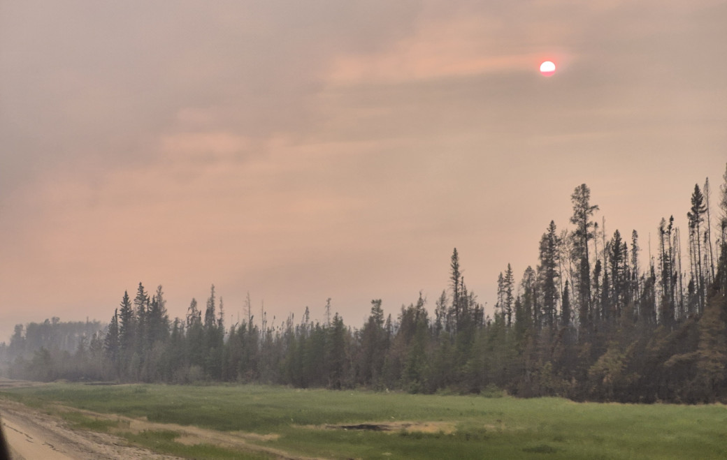 Drivers are asked to slow down on Highway 58, as visibility is often limited and fire crews, heavy equipment and emergency response personnel are working in the area (June 5).
Structure protection has been deployed within the community of Chateh, and power to the Town of Rainbow Lake and Chateh is not currently impacted. ATCO crews continue to work on repairing damaged powerline infrastructure within the fire. Telus has completed repair work on communication infrastructure, which had been damaged, to reestablish communications for the Town of Rainbow Lake.
Please slow down
Travellers on Highway 58 should expect delays (check 511 for updates). For everyone's safety, drivers are asked to slow down to 50 km/hour through the signed, active wildfire area of HWF036, as there are fire crews, heavy equipment and other personnel in the vicinity of this route. Along with varying and often quite limited visibility, driving at — or anywhere near — the normal speed limit (100 km/hour) can be dangerous.
The cause of this wildfire (HWF036) remains under investigation.
HWF037
This wildfire is within the Buffalo Head Hills, about 33 km west of the community of Tall Cree First Nation South. It is out of control at about 940 ha.
Heavy equipment and ground crews continue making good progress building a containment line with a current focus on the south side. This will be followed by work on the eastern side, along a corridor between two previously burned areas that is stalling growth to the east-southeast. Bucketing helicopters, fire crews and airtankers (dropping retardant) supported overall efforts to suppress this wildfire today. There is currently no threat to communities, and its cause is under investigation.
HWF040
This wildfire, which is east of the La Crete Ferry and just south of Highway 697, is being held at about 395 ha. With the progress made on this wildfire, crews have been able to remove the structure protection previously put in place and evacuated residents have returned home.
Firefighters with helicopters, water trucks, and heavy equipment support continue to action this fire today.
Travellers on Highway 697 should expect delays (please check 511 for updates). The cause of this wildfire remains under investigation.
Smoke from wildfire on the Alberta-B.C. border
Residents and others on the western side of the forest area may see smoke from a wildfire (HBZ001) currently burning along the provincial border. The High Level Fire Centre is in regular contact with its B.C. counterpart to monitor this wildfire. The Government of Canada also monitors smoke conditions across the country.
In 2025, there have been 47 wildfires in the High Level Forest Area to date, burning more than 38,000 ha.
To view wildfires on a map and for live updates, download the Alberta Wildfire App or visit the Alberta Wildfire Dashboard. Learn more about wildfire status definitions used in Alberta.
Fire ban
A fire ban is now in effect throughout the entire High Level Forest Area. Under this ban, all outdoor wood fires are prohibited and existing fire permits are suspended.
Prohibited:
- All outdoor wood fires, including wood campfires on public and private land, designated firepits and backyard firepits
- Barbecue charcoal briquettes
- Fireworks and exploding targets
Allowed:
- Propane fire pits and natural gas-powered appliances
- Indoor wood fires
- Open flame oil devices
The fire ban will remain in place until conditions improve.
See the fire ban fact sheet for more information.
Visit Alberta Fire Bans to see the boundaries of the fire ban implemented on May 29, 2025.
Safety near burnt areas
We urge residents and members of the public to use extra caution near burnt areas. There are many hazards that may not be visible, such as deep-burning ash pits and falling trees. Burnt trees can be a serious hazard, and trees that may look healthy — with green needles or leaves — could have burnt-out roots under the ground and fall unexpectedly. Trees and powerlines could also fall on the road and block your vehicle. Do not approach powerlines, as they could be energized.
Illegal use of drones near wildfires
Flying a drone near or over a wildfire endangers our pilots and forces us to ground aircraft, causing delays in firefighting operations. There are significant fines for putting aircraft and people at risk. Please give firefighters the space they need to do their jobs safely.
Published on June 5, 2025 8:46 pm