The fire danger level in the High Level River Forest Area remains high. Please use caution with outdoor fires. See below re. fire advisory, which is now in place.
Fire permits needed
Please remember that fire permits are required for any type of burning in the Forest Protection Area, except campfires. Request your permit online or by calling 780-926-5407. Please note that there is now a fire advisory in place — see below for details.
Wildfire situation
HWF036 now being held
The Sousa Creek Wildfire (HWF036), which is between Rainbow Lake and High Level, on both sides of Highway 58, is now being held. It remains an estimated 52,672 hectares (ha) in size.
Caution advised
We urge residents and others in the area to use extra caution near burnt areas. There are many hazards that may not be visible, such as deep-burning ash pits and falling trees. Burnt trees can be a serious hazard — while trees with green needles or leaves, which may look healthy, may have burnt-out roots underground and fall unexpectedly. Trees and powerlines can also fall on the road, causing a hazard to those travelling by vehicle. Do not approach powerlines, as they could be energized.
Progress on HWF036
Firefighters, heavy equipment operators and aircraft personnel have been working hard over many weeks and have made excellent progress in containing and controlling wildfire HWF036. Additional efforts have been required on the west and southwest sides of the wildfire, where there are persistent hot spots, requiring that firefighters — with the assistance of heavy equipment — dig deep and soak these areas with water.
Aerial scanning has been requested to identify additional hot spots, which will help firefighters focus on priority areas, as we continue our efforts to fully contain and control this wildfire.
Please note that smoke may still be visible at times, as unburnt pockets of vegetation ignite in the interior of the fire.
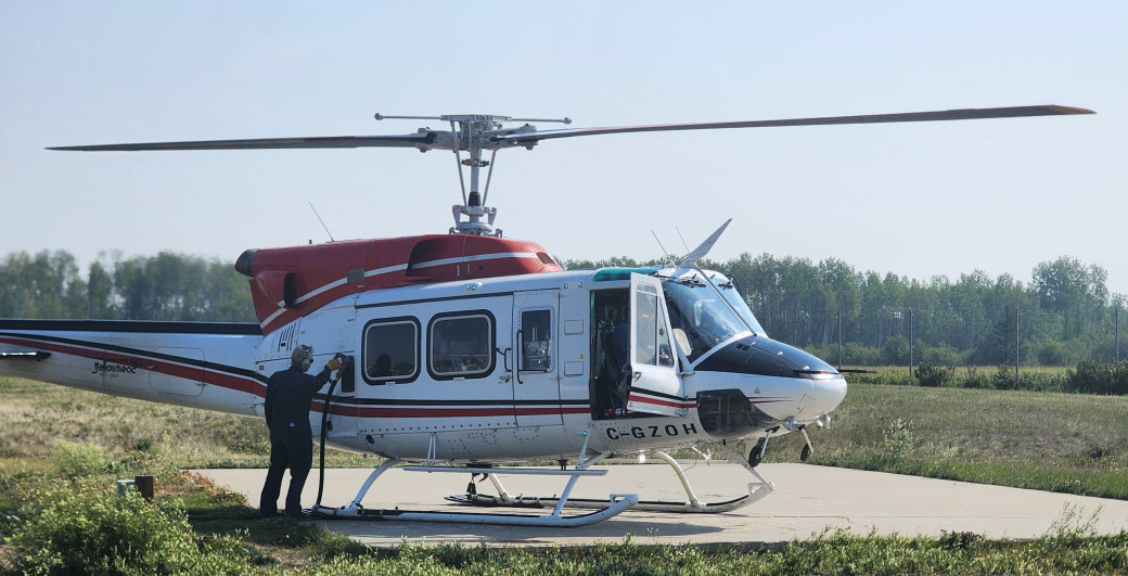 A member of the air crew refuels a helicopter at the High Level Airport/Footer Fire Base, before continuing to support wildfire operations in the area (July 17).
Border fires
Alberta Wildfire continues to work closely with its B.C. counterpart to monitor wildfires HBZ001 and HBZ002, which are located on the Alberta-B.C. border. Both wildfires are being held.
Wildfire south of Meander
HWF065, which is south of the community of Meander River and west of Highway 35, is under control at an estimated 650 ha. Its cause has been determined to be lightning.
Wildfire statistics
Since January 1, there have been 84 wildfires in the High Level Forest Area, burning approximately 55,000 ha. To view wildfires on a map and for live updates, download the Alberta Wildfire App or visit the Alberta Wildfire Dashboard. Learn about the wildfire status definitions used in Alberta.
Fire advisory
Given conditions and the forecasted weather over the coming days, there is now a fire advisory in the High Level Forest Area. Under this advisory:
- existing fire permits will remain valid, but extension requests may not be granted;
- new permits will be issued on a case-by-case basis; and
- heavy fuels (machine-piled brush piles and windrows) will be restricted.
Contact info
Mark Giles
780-285-4490
[email protected]
Published on July 17, 2025 11:59 am