The fire danger in the Grande Prairie Forest Area is moderate.
Cooler temperatures and recent rain have reduced the overall risk. However, wildfires can still start, especially in dry areas or during windy conditions, so it is important to continue using caution with outdoor fires and do your part to prevent wildfires.
Wildfire situation
GWF028 - The Hamelin Creek wildfire near Moonshine Lake Provincial Park
This lightning-caused wildfire remains classified as out of control and is estimated at 5,557 hectares in size. Recent significant rainfall has helped improve conditions on the ground, allowing firefighting crews to make steady progress — particularly in strengthening and building containment lines with the support of heavy equipment.
Alberta Wildfire continues to respond with firefighters, heavy equipment, and helicopters. Alberta Parks remains actively involved in supporting the wildfire response in the Moonshine Lake Provincial Park.
Saddle Hills County evacuation order and alert
While this wildfire does not currently threaten any homes or structures, an evacuation order and alert remain in place. Moonshine Lake Provincial Park remains closed.
See Alberta Emergency Alert for evacuation zone information and further details.
For more information, visit the Saddle Hills County webpage or Facebook page.
GBZ001 - The Kiskatinaw River wildfire
This wildfire is estimated at 26,623 hectares and remains classified as out of control. It is burning near the Alberta–British Columbia border, approximately 68 km west of Grande Prairie, in the Kelly Lake area. Continued progress is being made, thanks to cooler weather and rain in the forecast. Despite these favourable conditions, the wildfire continues to pose a potential risk to nearby areas.
Fire activity remains low and is mostly smouldering. Showers or thundershowers are possible this afternoon, though the long-term forecast points to warmer and drier conditions.
The BC Wildfire Service is the primary agency in command of working to contain this wildfire. Alberta Wildfire is supporting these efforts as needed. The incident management team is also working closely with the County of Grande Prairie and the Peace River Regional District to ensure a coordinated regional response.
For more information on this wildfire and others in B.C., visit the BC Wildfire Service website.
County of Grande Prairie evacuation alert
The County of Grande Prairie's evacuation alert remains in effect.
- Alberta residents - for more details, visit the Alberta Emergency Alert website or download the app. For the most up to date information, go to the County of Grande Prairie website or their Facebook page.
- British Columbia residents - visit the Peace River Regional District website or their Facebook page.
GWF040 - Wildfire south of Grande Prairie
Alberta Wildfire continues to respond to this wildfire, located approximately 78 km south of Grande Prairie and 19 km east of Highway 40. The wildfire is estimated at 247 hectares in size and remains classified as out of control.
Steep terrain has made some areas difficult to access, but firefighting crews, heavy equipment, and aircraft remain actively engaged. Recent rainfall over the past few days has helped support firefighting efforts, slowing fire spread and improving firefighting operations. Crews continue to focus on priority areas, building containment lines and targeting hot spots.
Grande Prairie Forest Area statistics
Since January 1, there have been 41 wildfires in the Grande Prairie Forest Area, burning a total of 5,821 hectares.
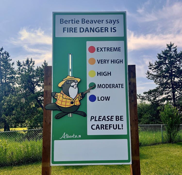 Look for the Grande Prairie Forest Area fire danger sign near the Forestry office at 10811 84 Ave, right across from No Frills.
Lightning-caused wildfires
Lightning is typical this time of year and has been detected across the forest area, with more expected throughout the week. This increases the potential for new wildfire starts. Lightning-caused wildfires can smoulder beneath the surface for several days before becoming active and visible when conditions are favourable, particularly during dry and windy weather.
If you see smoke or other signs of wildfire activity, report it immediately by calling 310-FIRE (3743). Early reporting helps firefighters respond more quickly and reduces the risk of wildfire spread.
Choose your campfire site
In campgrounds or recreational areas, use the designated stoves, fire rings or fire pits. These are designed to keep fires from spreading and are the best choice for a safe campfire. When outside of a campground, use sites that are clear of dry grass and vegetation. Clear the site down to bare mineral soil, keep it sheltered from wind and always have water nearby in case your campfire escapes.
When you're done, always soak it, stir it and soak it again until the ashes are cool to the touch. Never leave a campfire unattended. See Campfire Safety for more information.
Evacuation preparedness
Have an emergency plan in case you and your family need to evacuate. Individuals and families should be prepared to take care of themselves for at least 72 hours. Be sure to also plan for your pets and livestock in case of an evacuation.
- Evacuation alert: Issued when there is a potential threat. This gives residents time to prepare so they are ready to act quickly by packing essentials, collecting important documents, fueling vehicles, making arrangements for pets and livestock, etc.
- Evacuation order: Issued when there is an immediate risk to life or safety. Residents may be directed to leave the area immediately—there may be no time to gather belongings.
Contact info
Kassey Zatko
780-538-5327
[email protected]
Published on June 17, 2025 4:41 pm