Types of maps
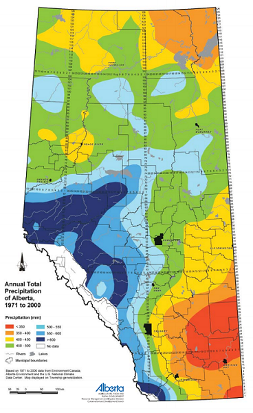
Alberta offers a wide range of mapping resources to enhance understanding of many diverse subjects and issues. The two major types of maps are reference maps and thematic maps. To the right is a typical thematic precipitation map indicating precipitation across the province. Thematic maps depict information about a specific topic in a geographic area. For more information:
The second major type is a reference map which shows geographic boundaries along with features. Topographic maps are a familiar type of reference map. See Natural Resources Canada for the Topographic map guide.
Static maps of Alberta
A variety of maps and geospatial data are available for download from the GeoDiscover Alberta portal including PDF Maps. Maps available here are subject to copyright of the Province of Alberta. These products are owned by the Government of Alberta and protected by copyright law. Review the Open Government Licence – Alberta for the usage terms and proper attribution statements.
Provincial Base Map Series
The Provincial Base Map Series are large format maps available in maps scales of 1:750 000; 1:1 000 000; and 1:2 000 000. These maps are updated annually. The map projection used is custom 10 degree Transverse Mercator projection with the central meridian located at 115 degrees. The underlying horizontal map datum is North American Datum of 1983. To view these maps, visit GeoDiscover Alberta and use the search box and scale facets to locate the maps you want to view. All maps are available in PDF format.
Other maps
For more detailed provincial map coverage the Provincial Resource Access Map Series provides coverage of Alberta at a scale of 1:50 000. The Provincial Access Topographic Series provides topographic coverage of Alberta at a scale of 1:250 000. These maps are not currently being maintained.
A collection of Historical Maps is also available providing information on a range of land cover inventories. To view these maps, visit GeoDiscover Alberta and use the search box and scale facets to locate the maps you want to view. All maps are available in PDF format; historical maps may be available in other formats, refer to the metadata on GeoDiscover Alberta for details.
If there are other government map collections you would like to see added to the portal contact the Provincial Geospatial Centre (see bottom of this page for contact details).
Requesting geospatial products
The Government of Alberta provides self-serve access to our data products through portals like GeoDiscover Alberta and Open Government. To request geospatial products unavailable for self-service due to size or licensing constraints, follow the instructions in the metadata under “Distribution Information”. To view the metadata, click on the title of the dataset you want to request.
Note: Distribution through our order desk is a service to the user and the information provided remains copyrighted to the Government of Alberta.
Before requesting
Check to see if your product is available for download by searching the data and map collections on GeoDiscover Alberta. Use keywords to search the catalogue and use the facets on the side panel to narrow down your results. Click the “Data Links” pull down on each record to view available download options. To learn more about the record, click the title and read the metadata.
Answers to common questions are contained in the metadata which you can search using CTRL + F (find) or by clicking the links at the top of each record:
To find someone to answer questions about the dataset look under “Point of Contact.”
To find instructions on how to order a dataset look under “Distributor” or “Distribution Information.” If no distributor is listed, follow the instructions in “Contact Instructions.”
To find out details on the type of licensing associated with the dataset look under “Resource Constraints.”
Request instructions
When using a generalized email from the metadata record to request a data product be sure to include the following information:
- Name of product(s) and link(s) to the metadata record(s)
- All necessary contact information for your organization including a phone number
- The subject line indicated the ordering instructions
Note: Products are only available in the formats listed in the metadata, many products may require GIS software to view.
You may need to sign a licence agreement before the product is distributed.
Delivery options are dependent on the product’s size.
If the metadata record indicates the product is available from Altalis, follow the instructions on their website to complete your order. If you require help contact the Altalis Help Desk (see bottom of this page for contact details).
Publications
Contact
Connect with the Provincial Geospatial Centre:
Hours: 8:15 am to 4:30 pm (open Monday to Friday, closed statutory holidays)
Provincial Geospatial centre – [email protected]
GeoDiscover Alberta – [email protected]
Data Order Desk – [email protected]
Altalis Help Desk – [email protected]
Mailing address:
Provincial Geospatial Centre
14th Floor, Oxbridge Place
9820 106 Street NW
Edmonton, Alberta T5K 2J6