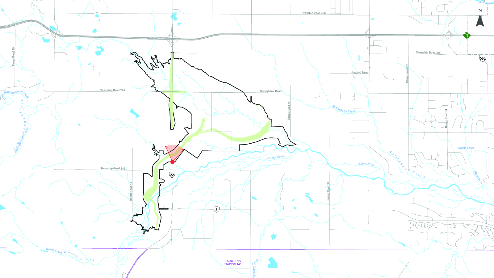
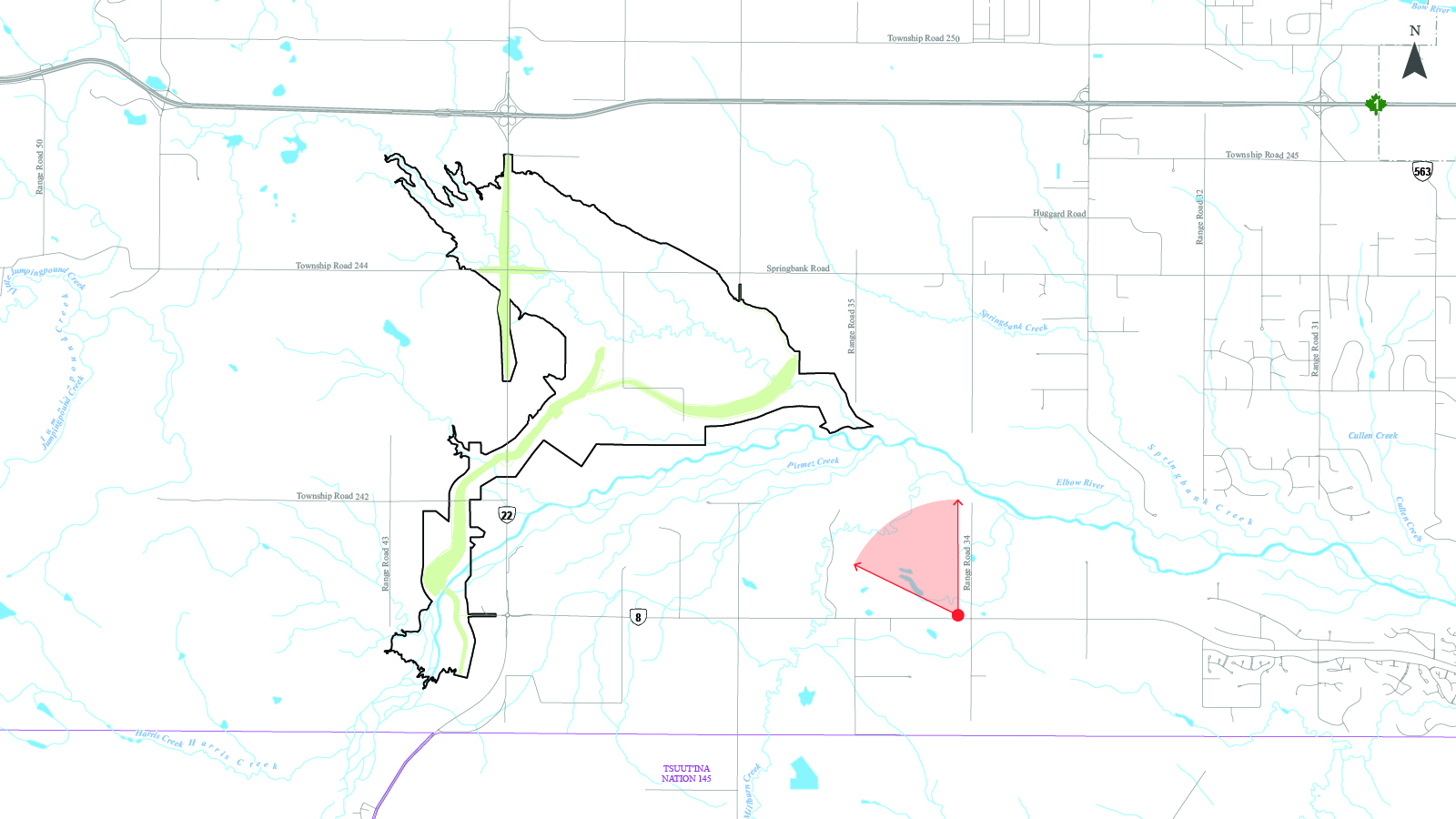
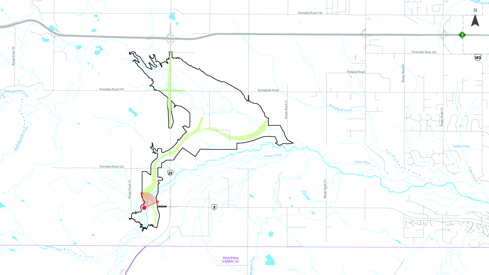
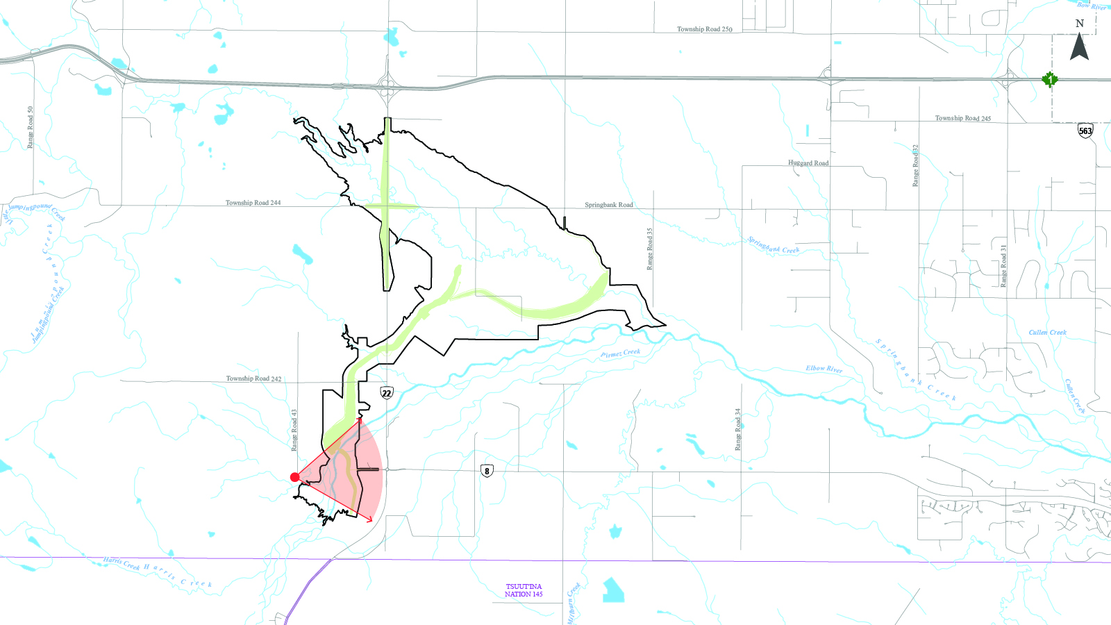
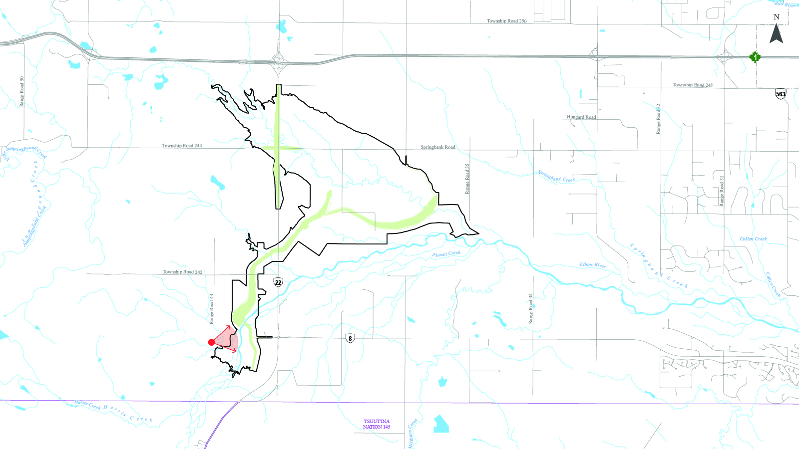
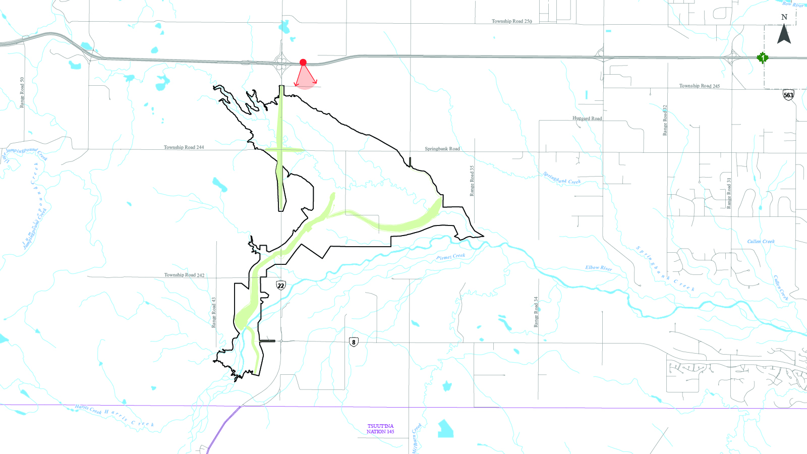
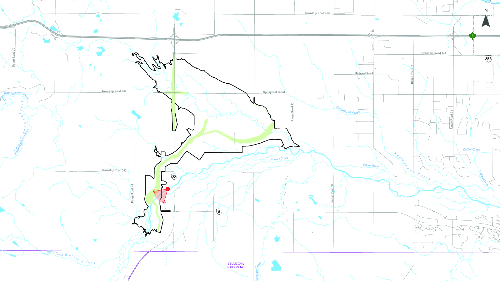
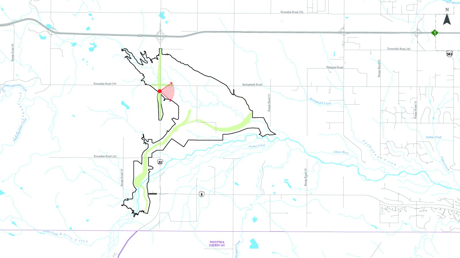
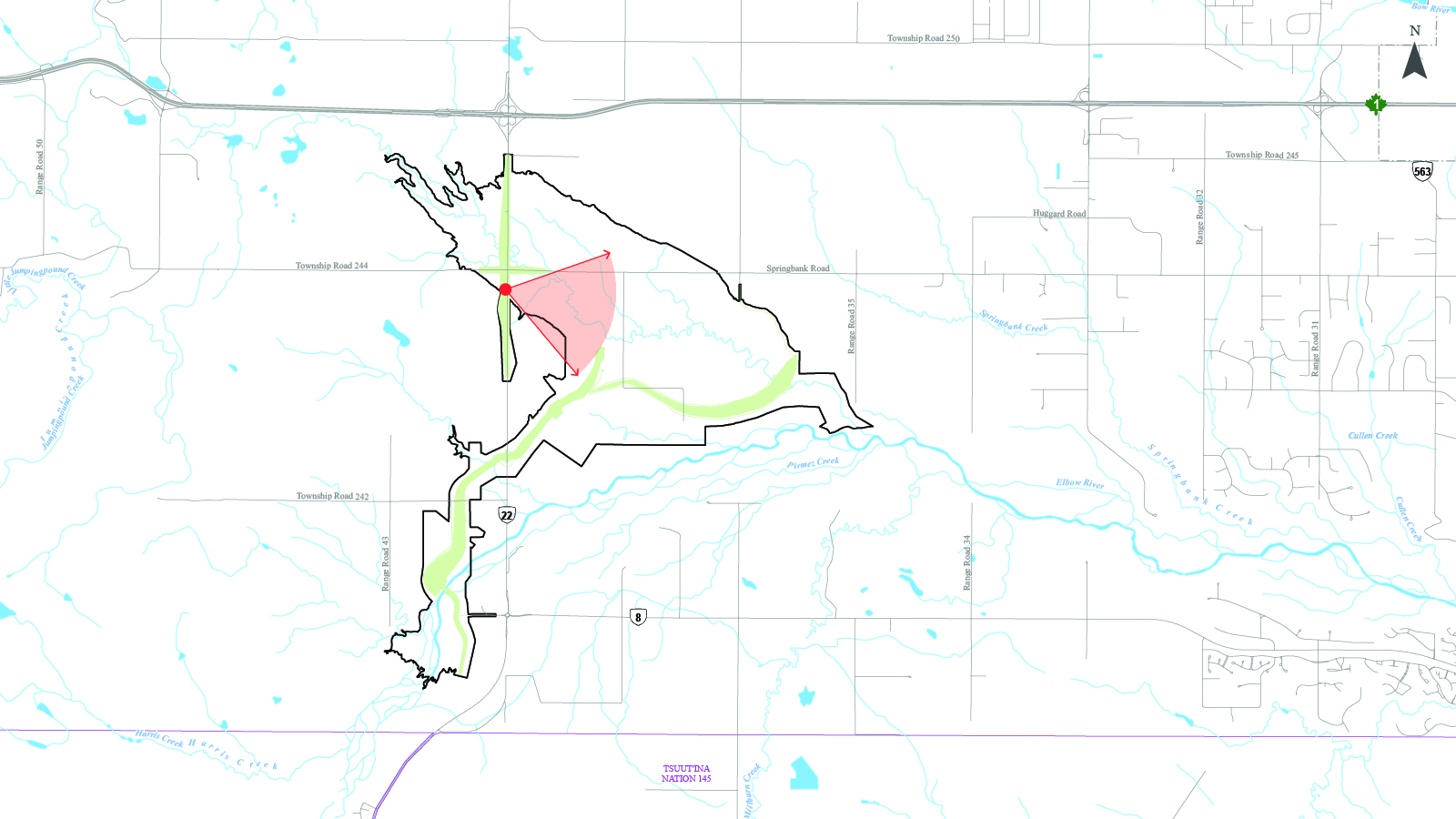
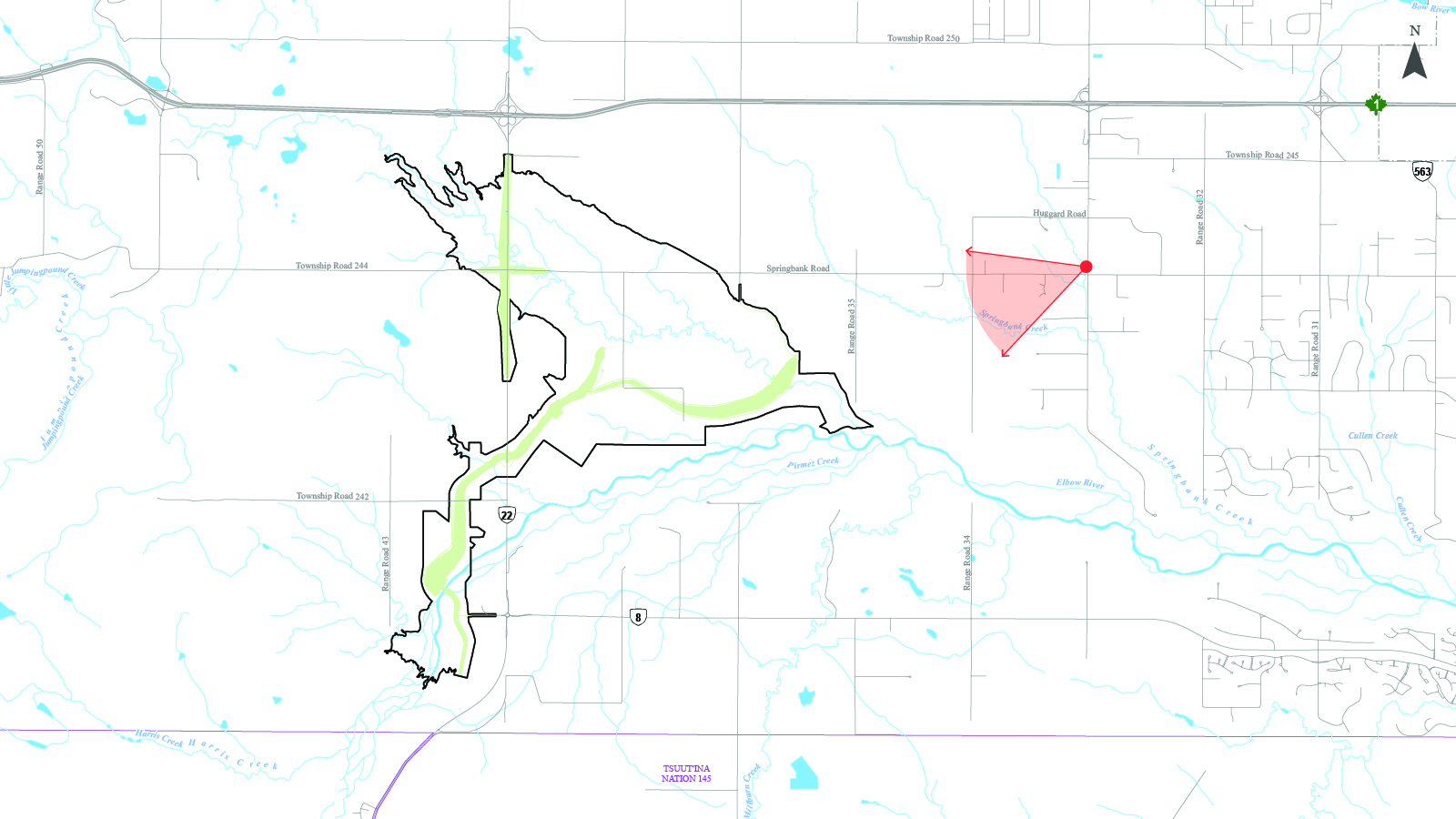
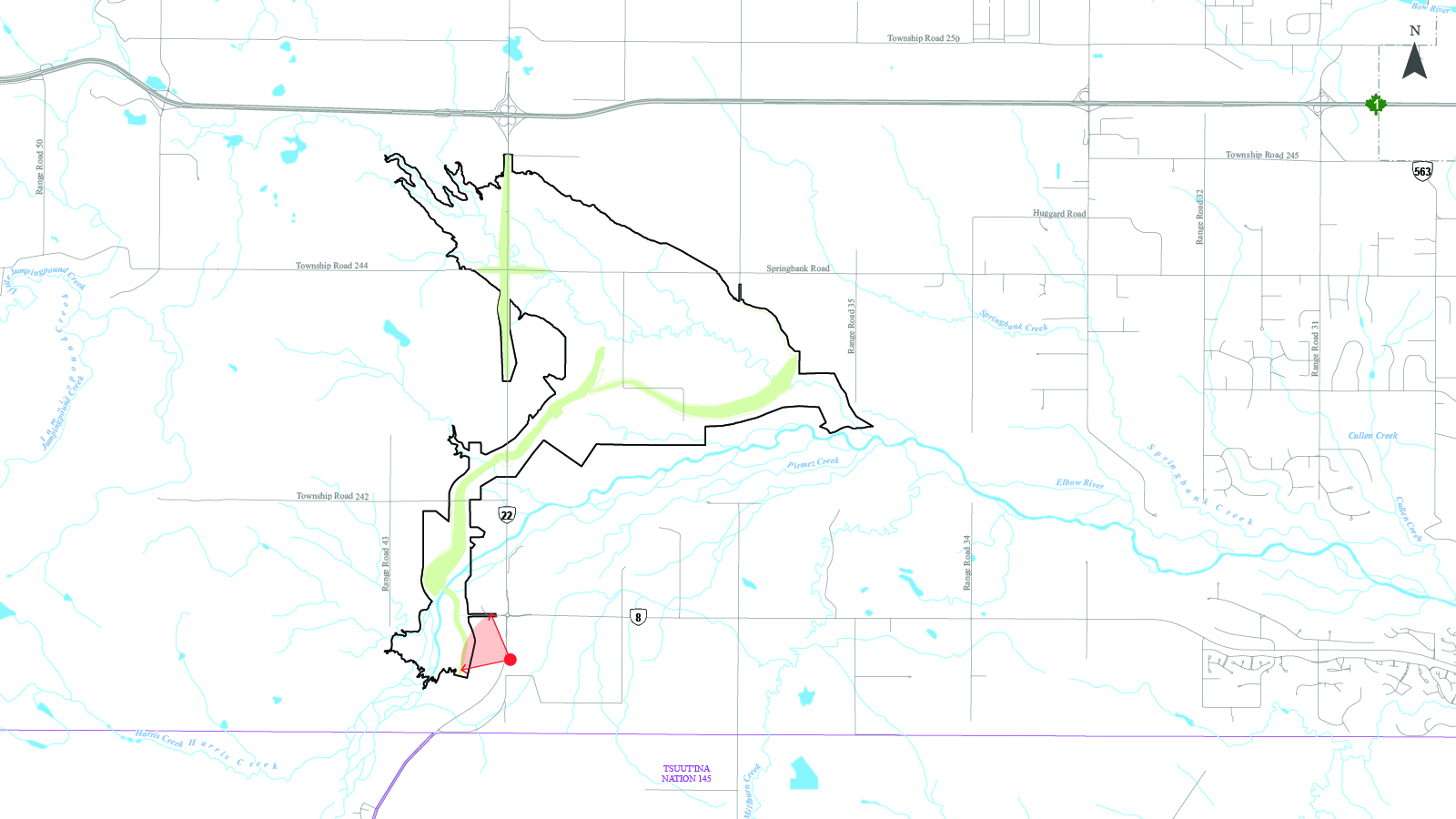
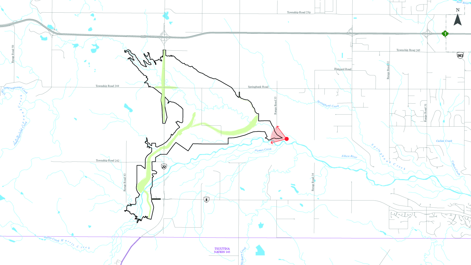
Reservoir map
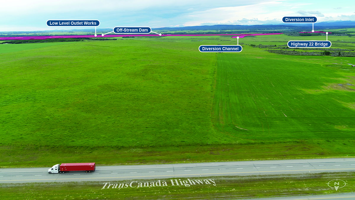
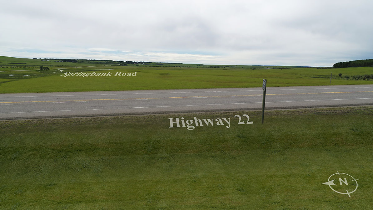
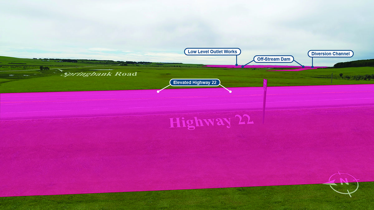
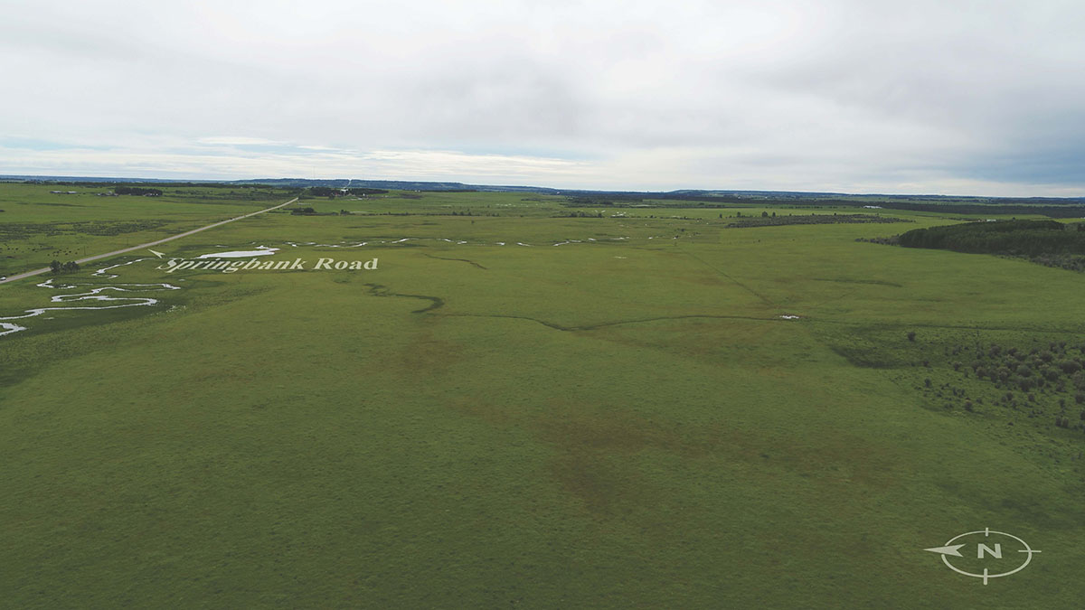
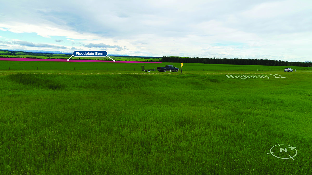
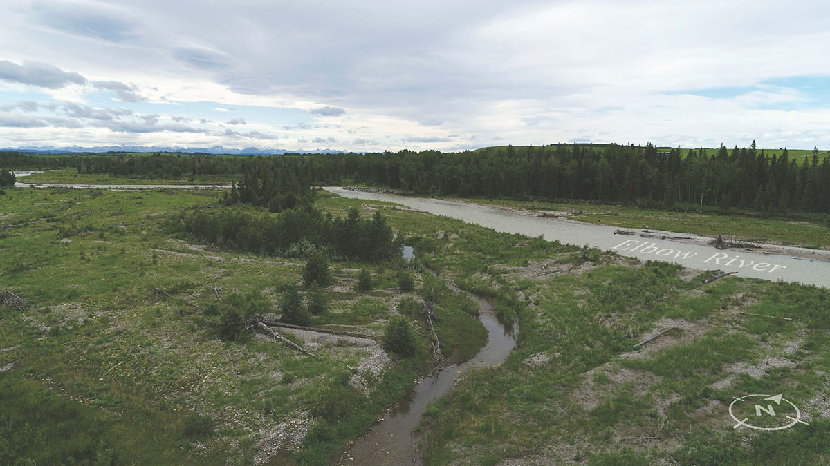
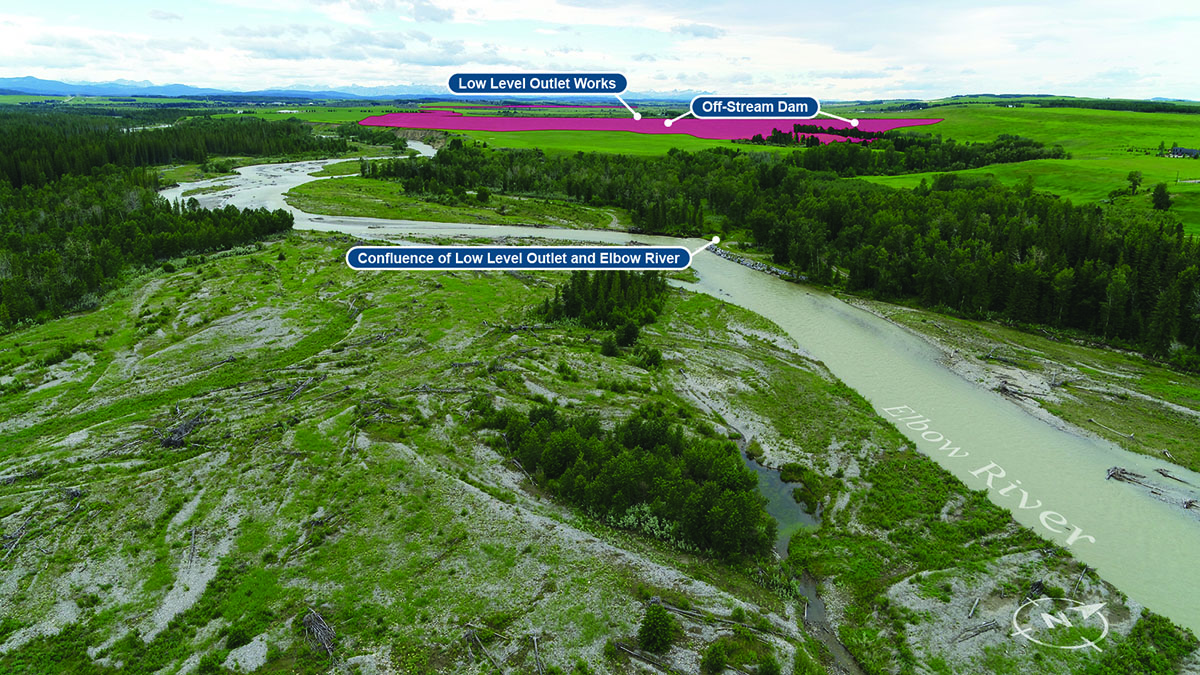
This map and accompanying images were developed to help illustrate what the Springbank Off-stream Reservoir will look like, if approved and built.
The photos were taken of the project area in summer 2020, and computer imaging was used to render images of the reservoir infrastructure onto the existing landscape.
Click on each of the location points to see the corresponding photos below the map.
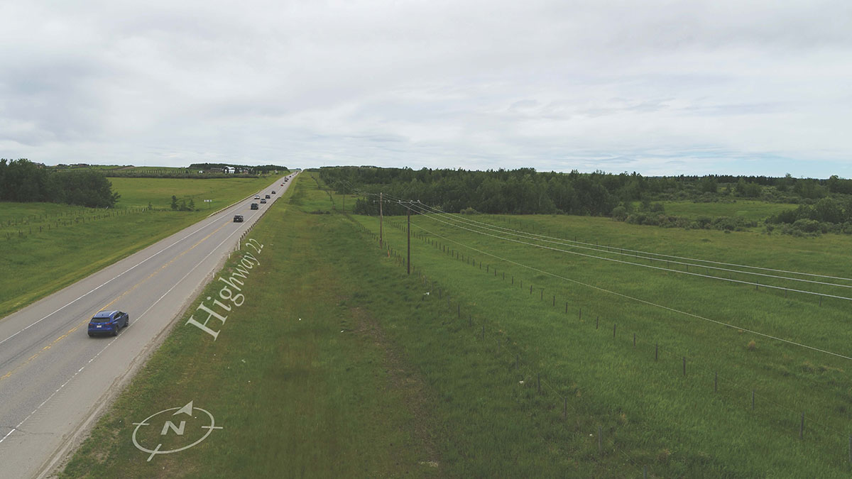
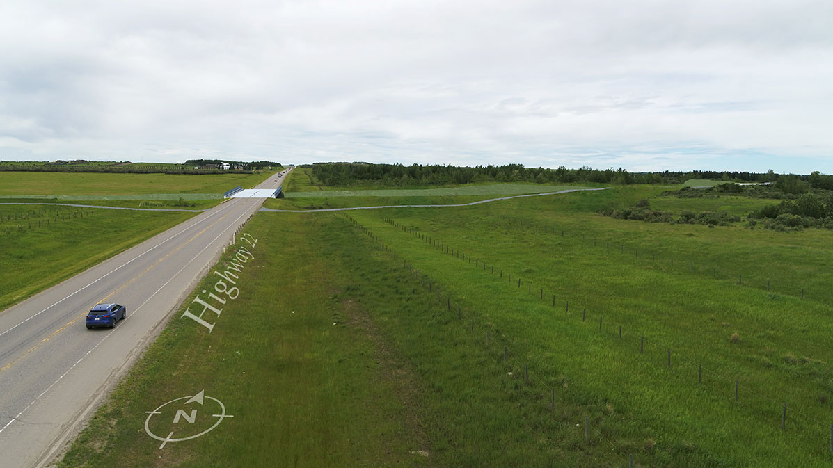
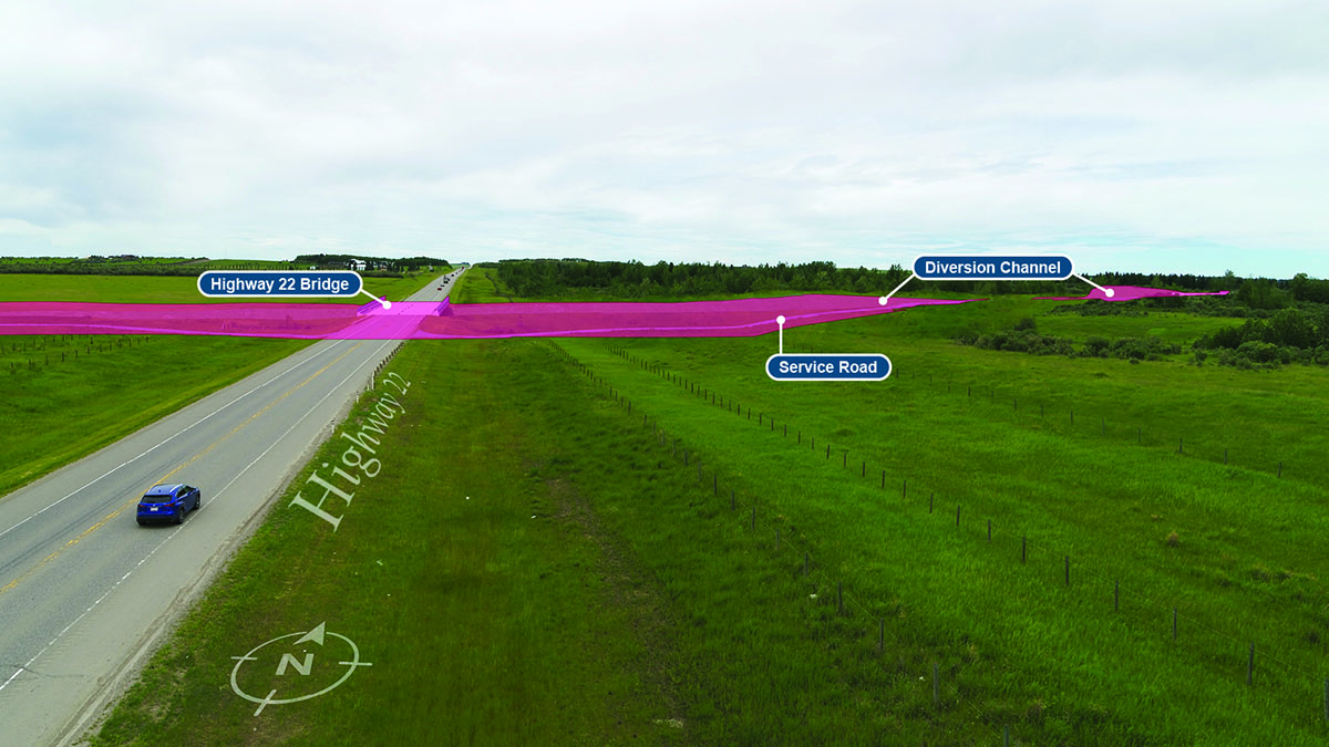
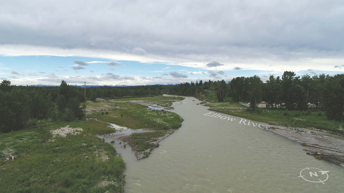
Looking North at the Structure
-
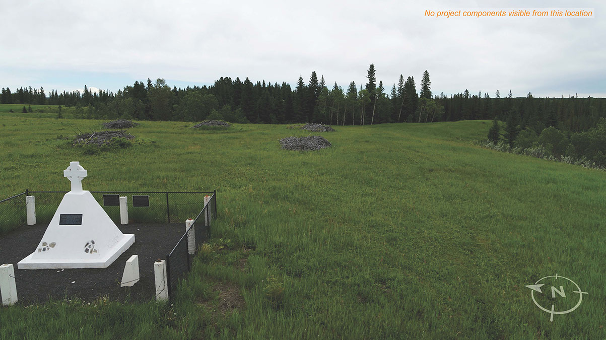
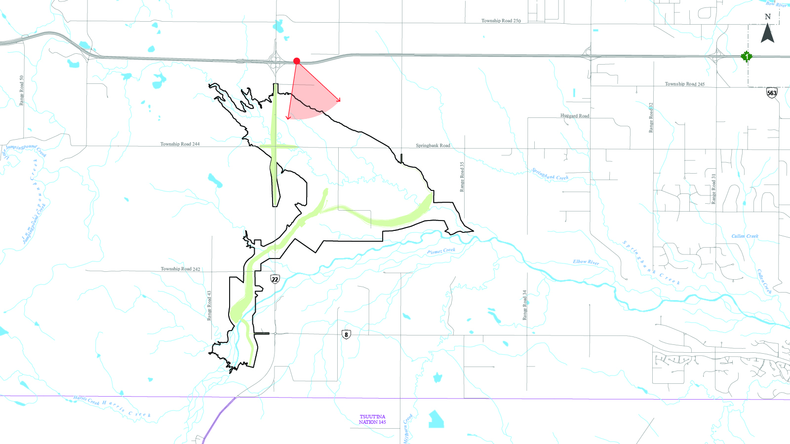
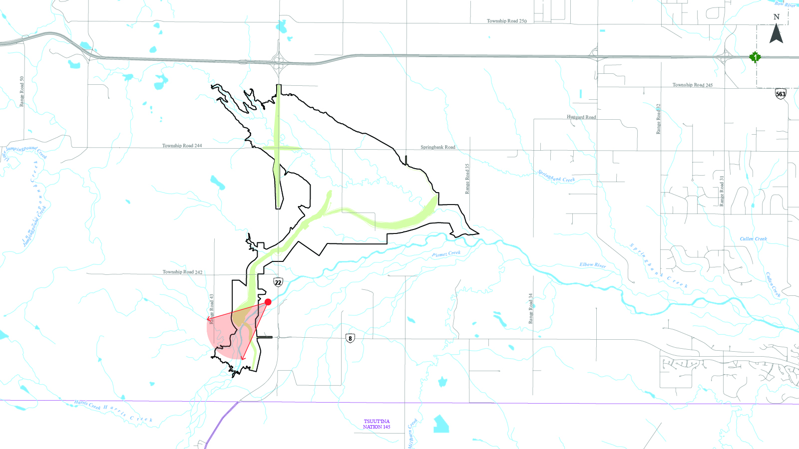
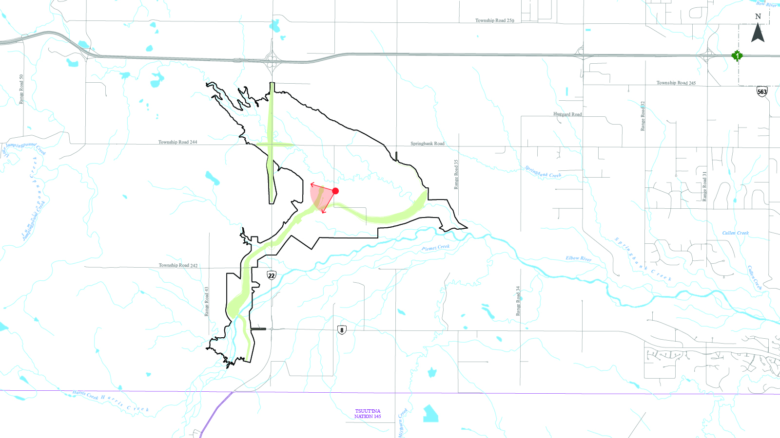
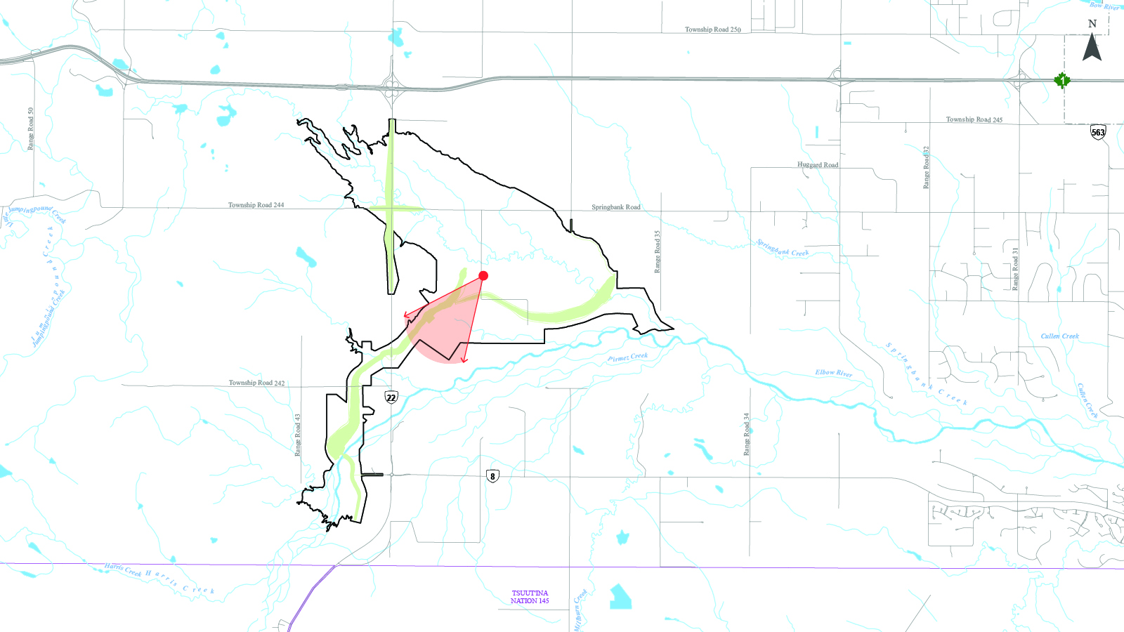
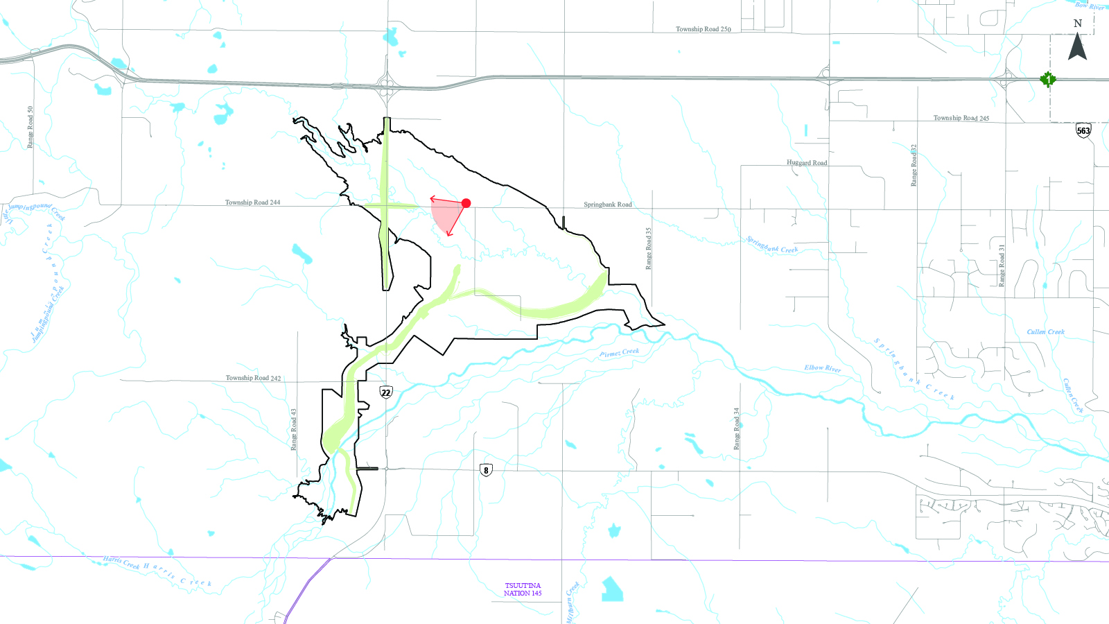
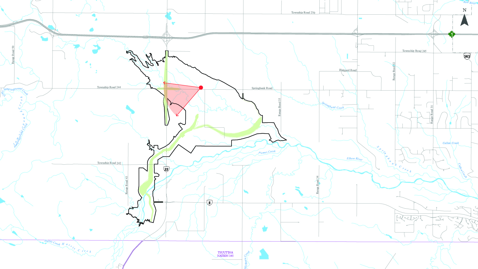
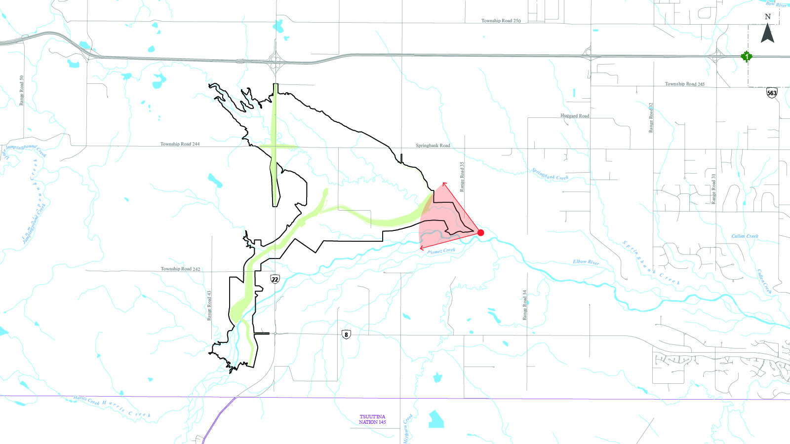
 Key map
61m elevation -
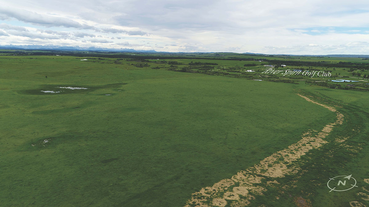
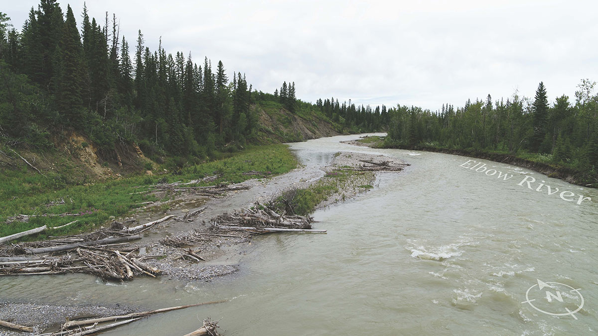
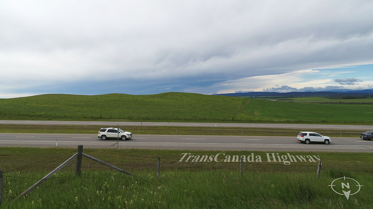
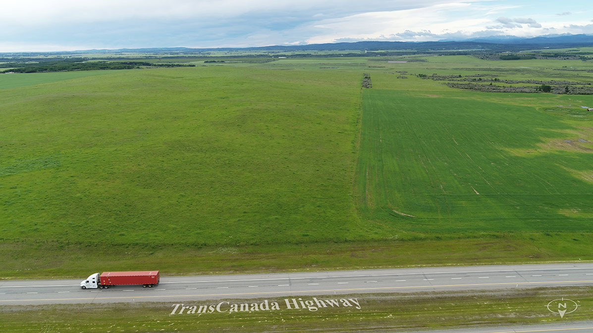
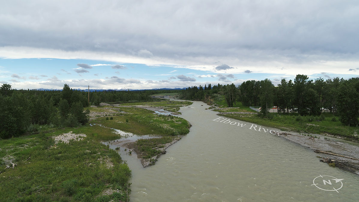
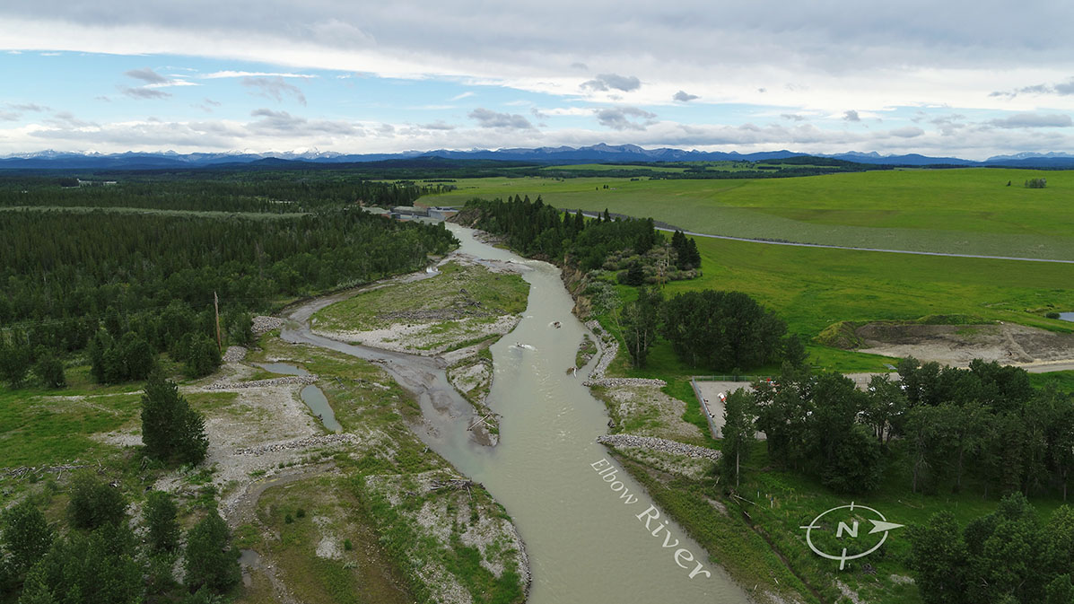
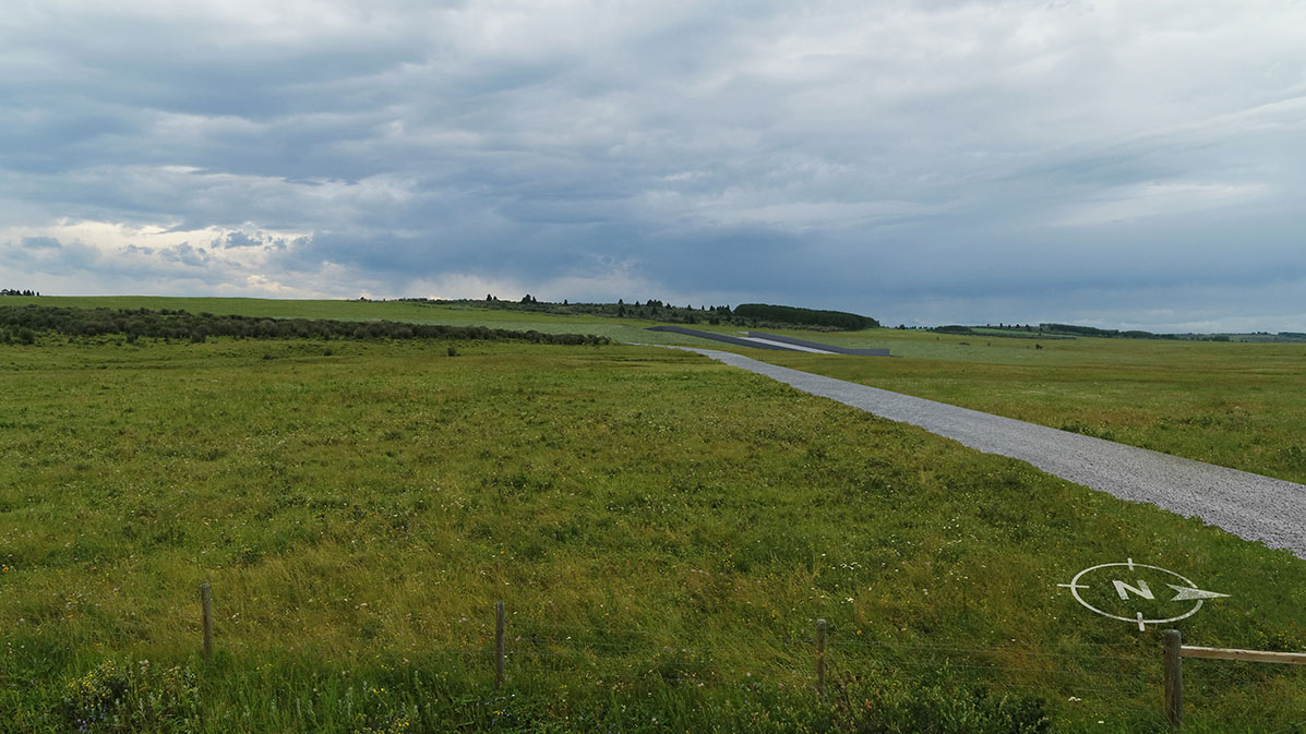
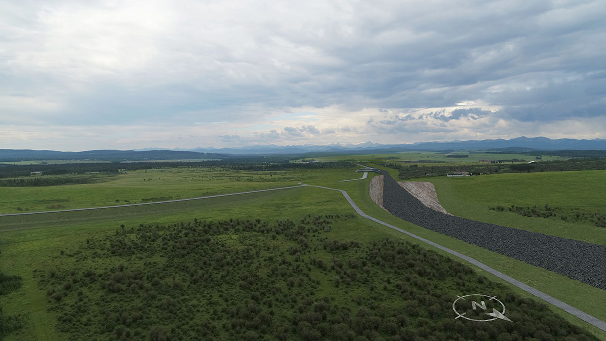
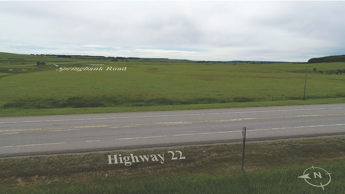
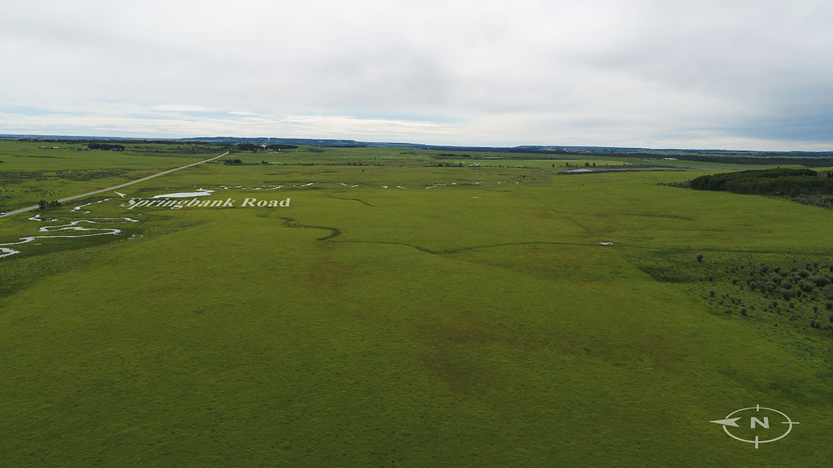
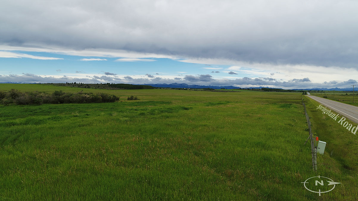
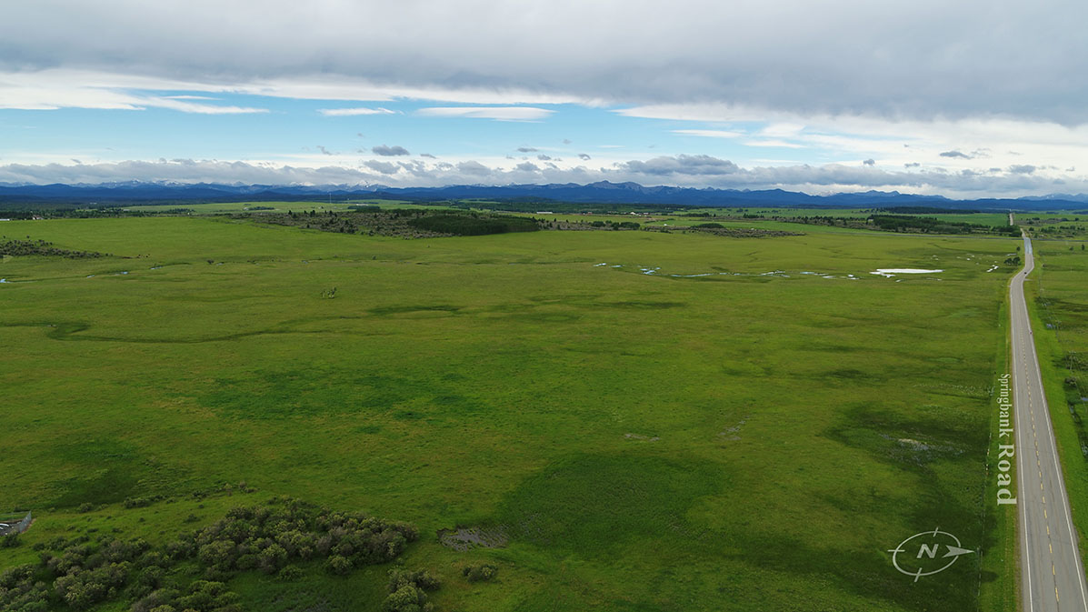
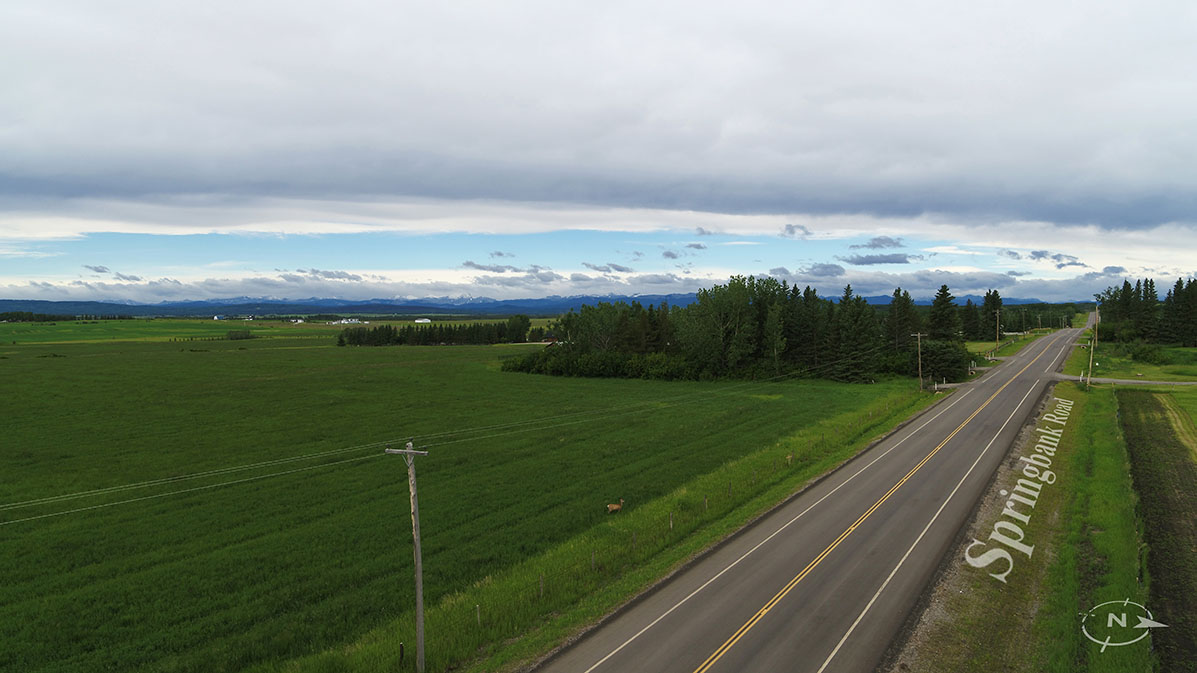
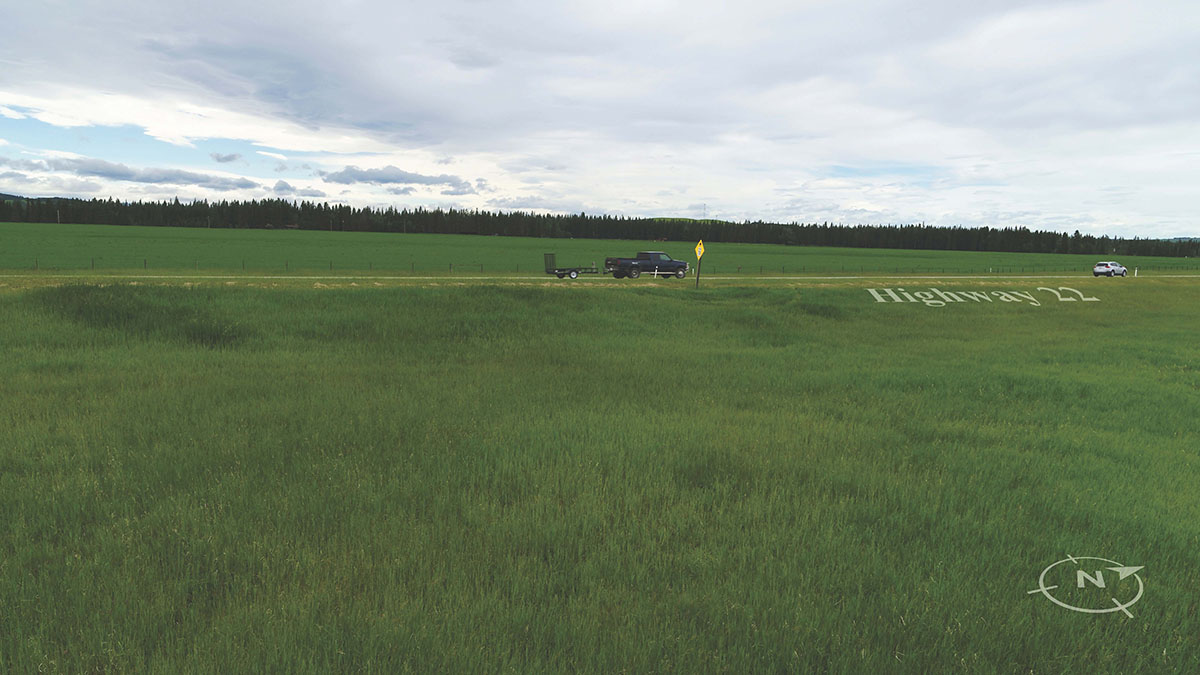
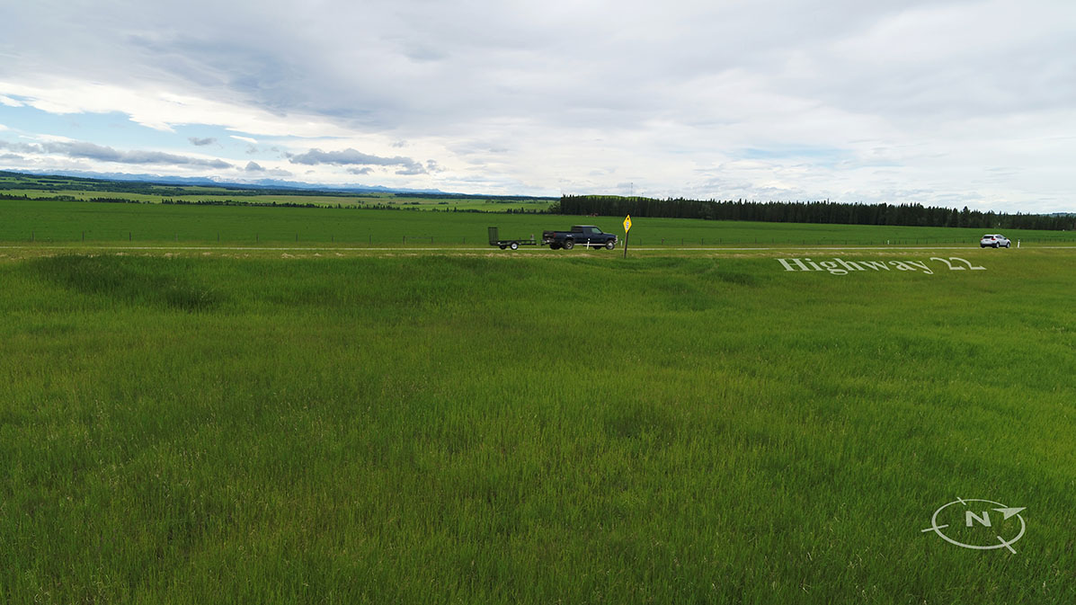
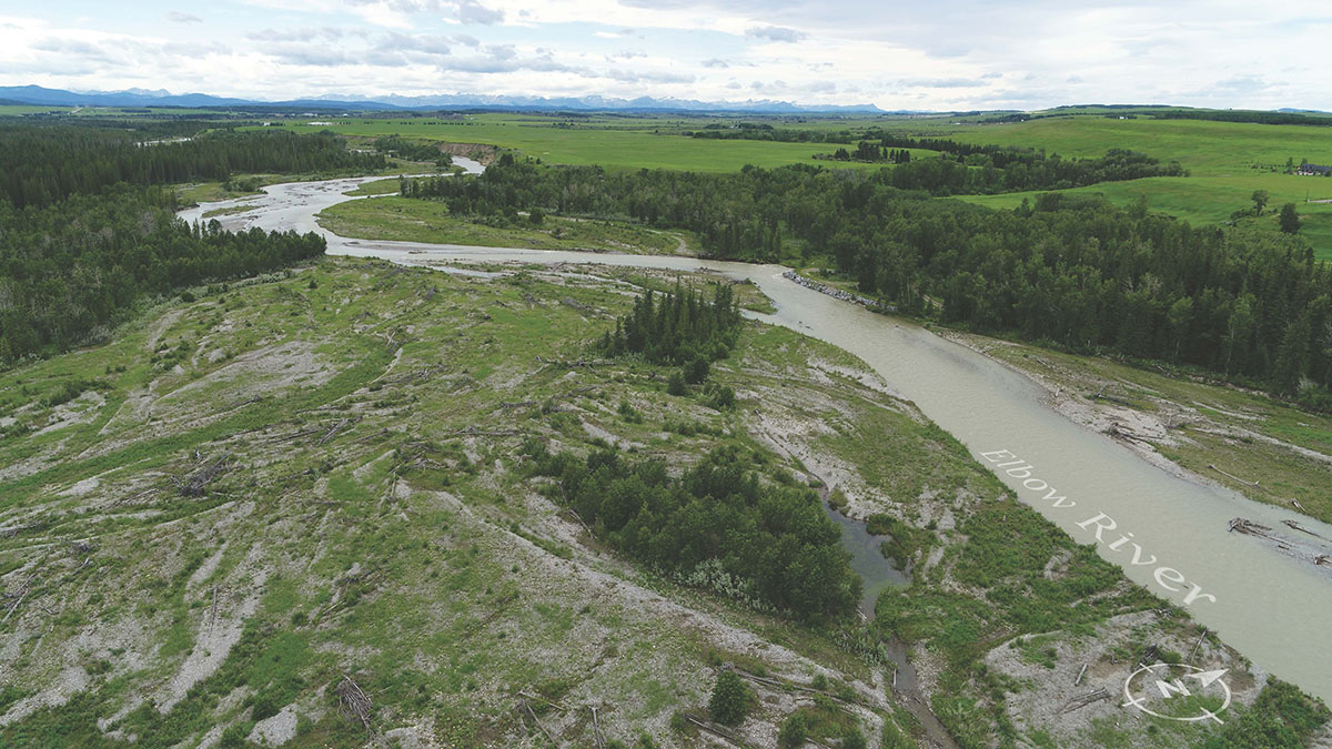
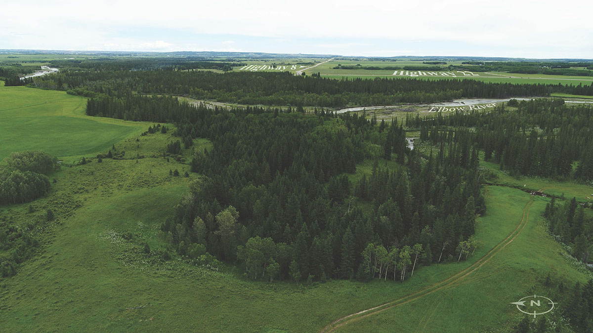 Original
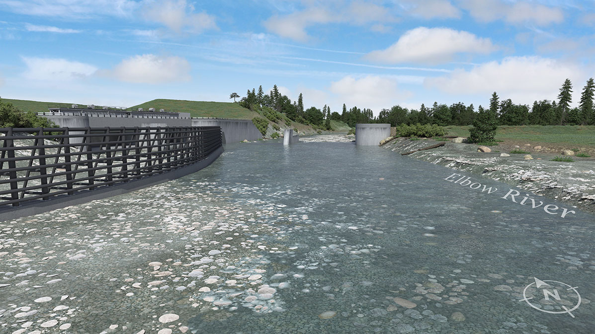
61m elevation -
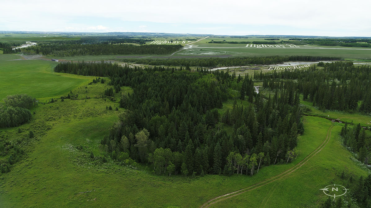 Rendition
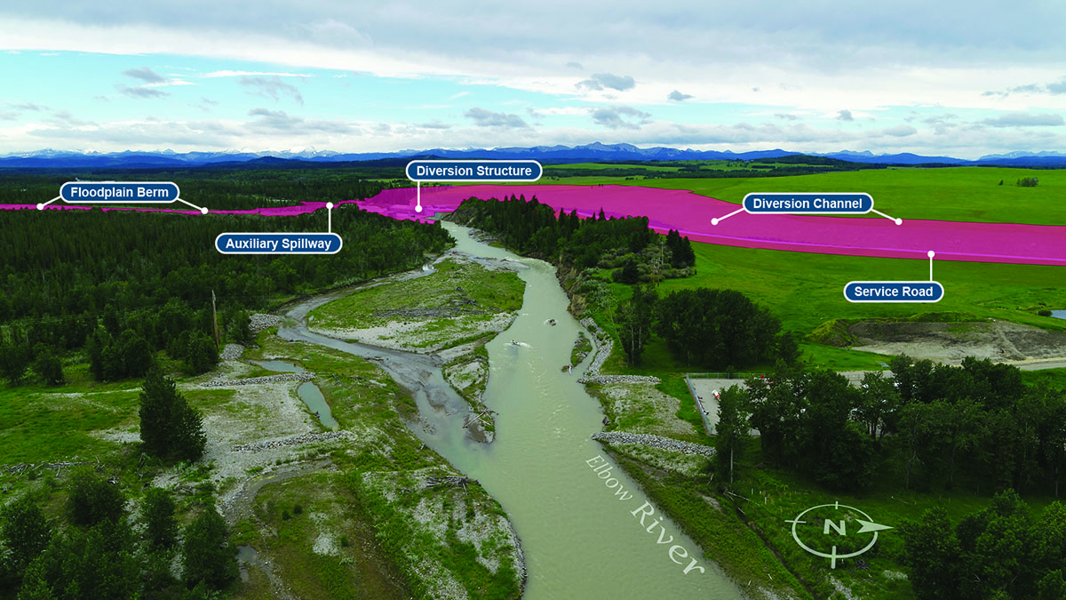
61m elevation -
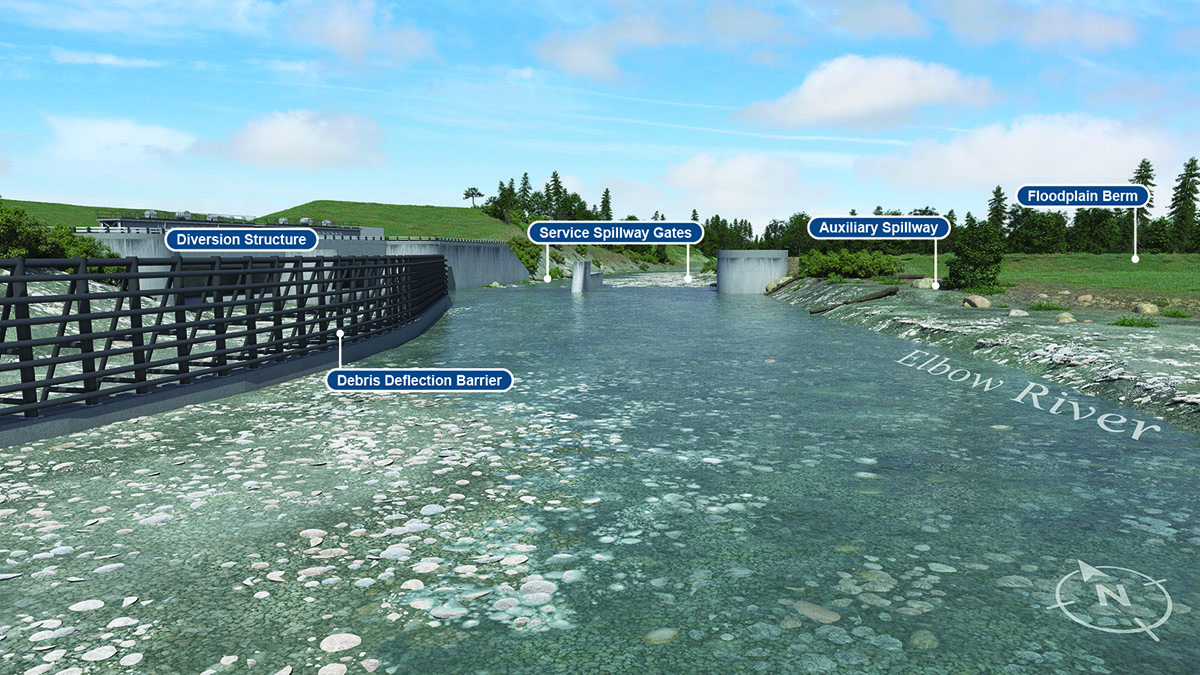
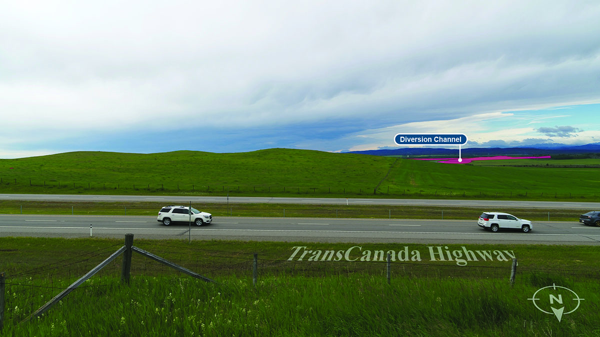
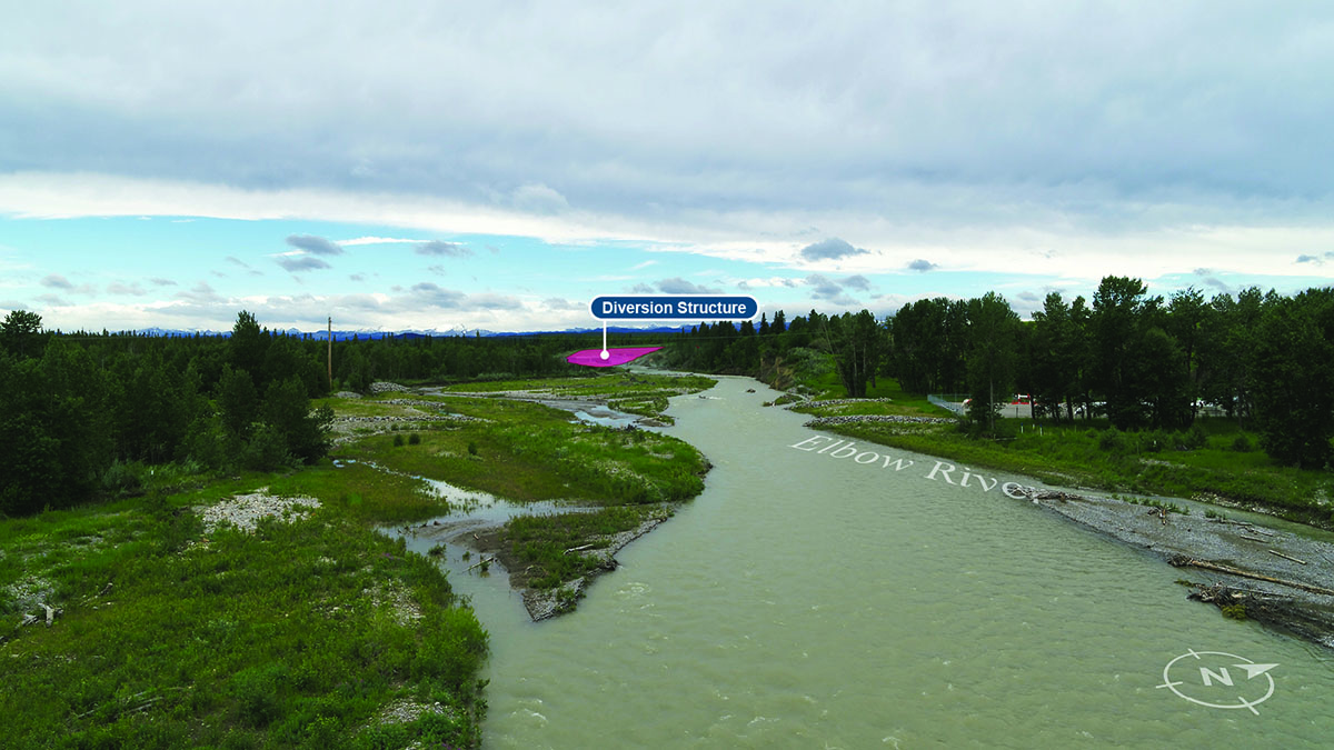
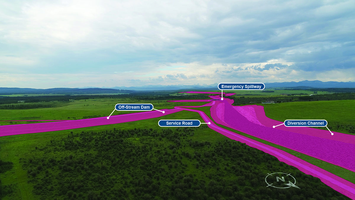
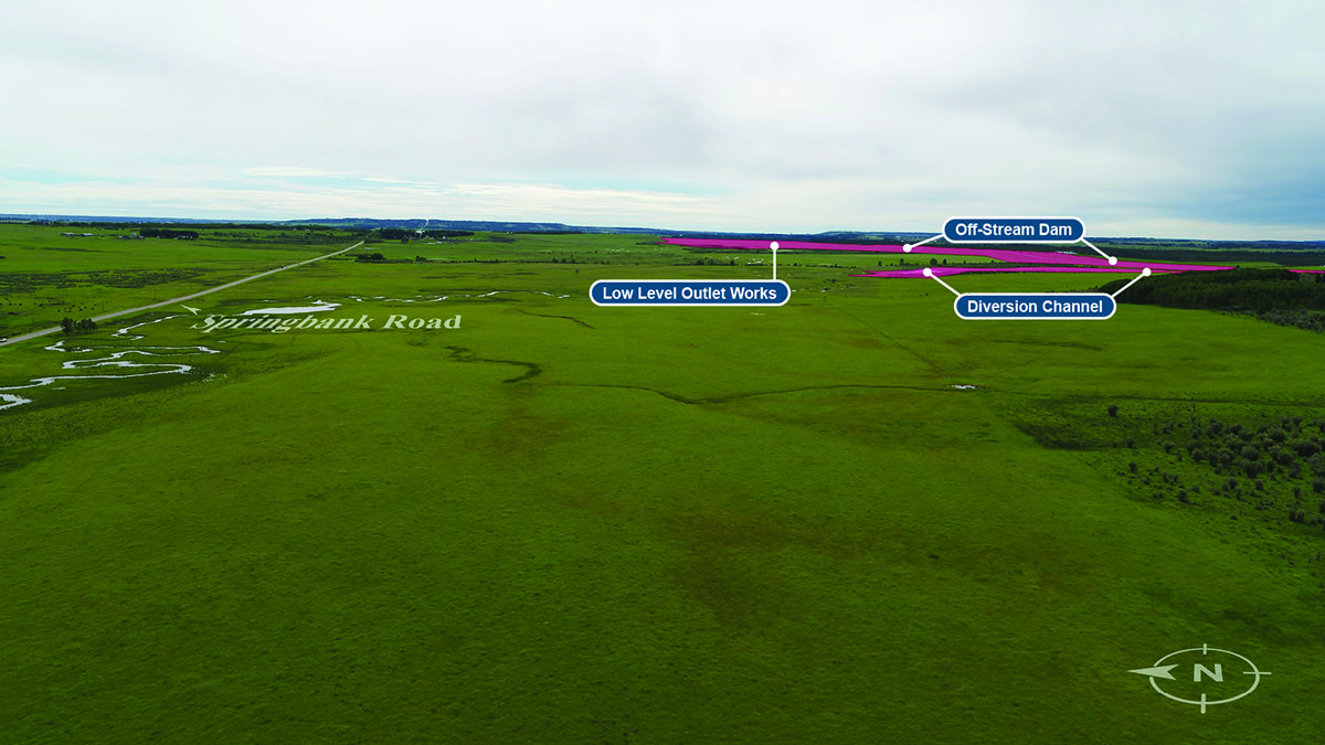
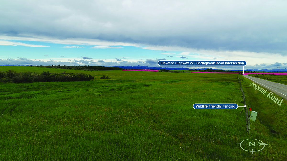
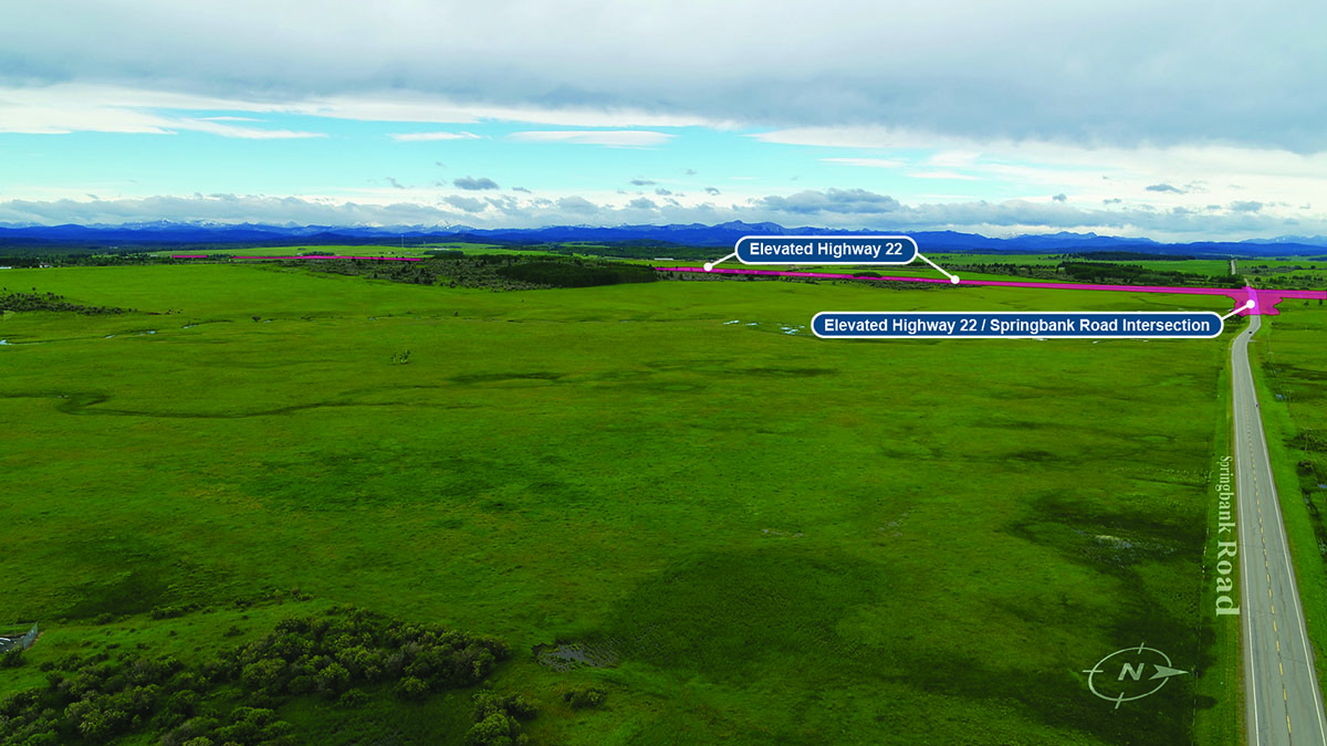
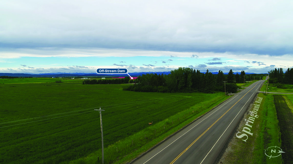
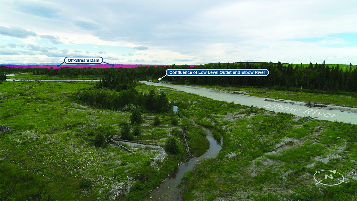
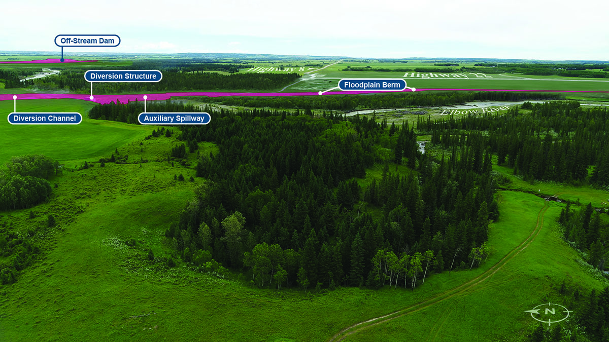 Annotated rendition
61m elevation -
 Key Map
2m elevation -
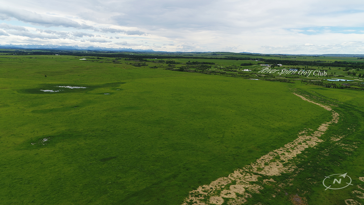
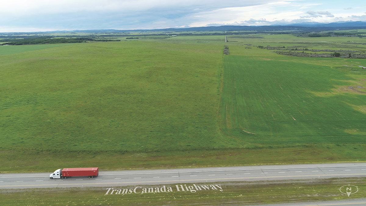
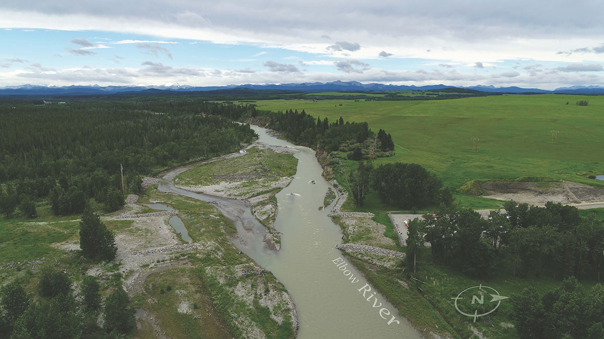
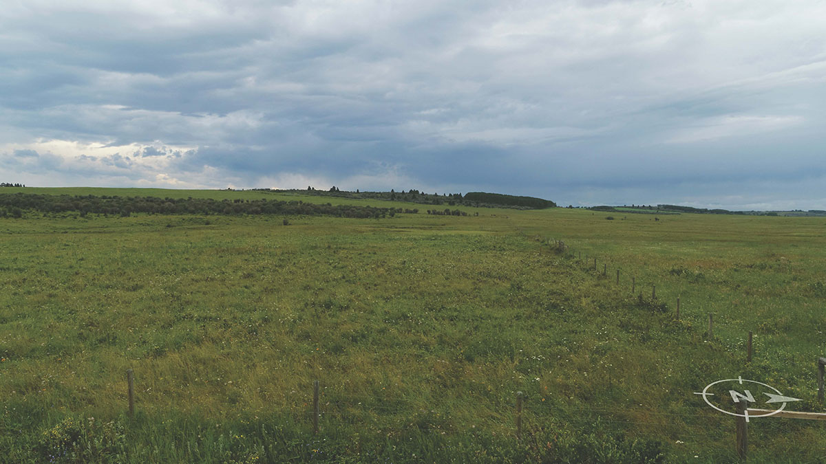
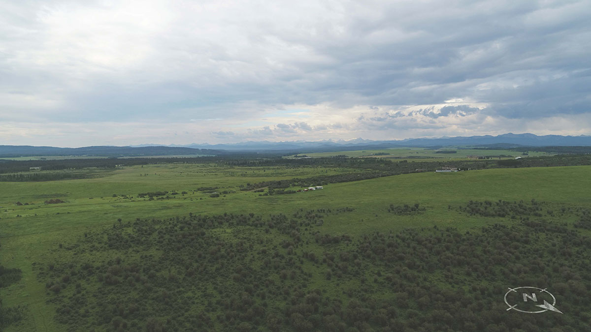
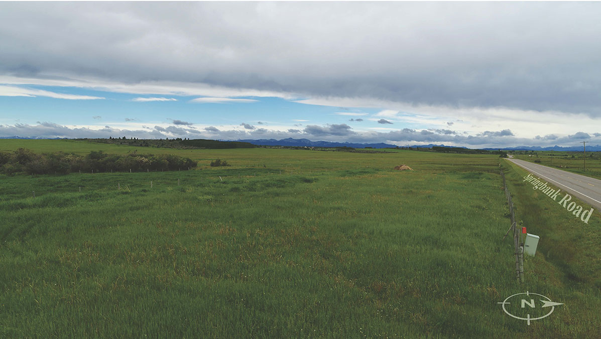
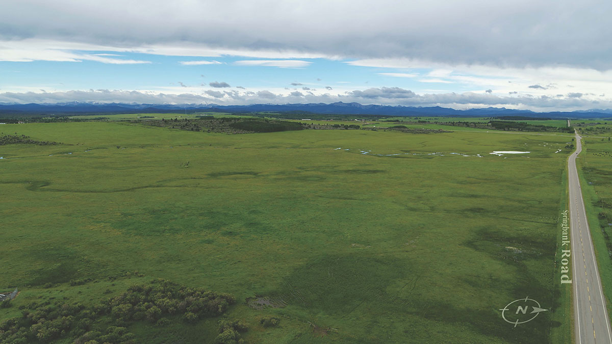
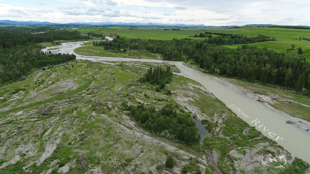
 Original
2m elevation
-
 Key map
2m elevation -
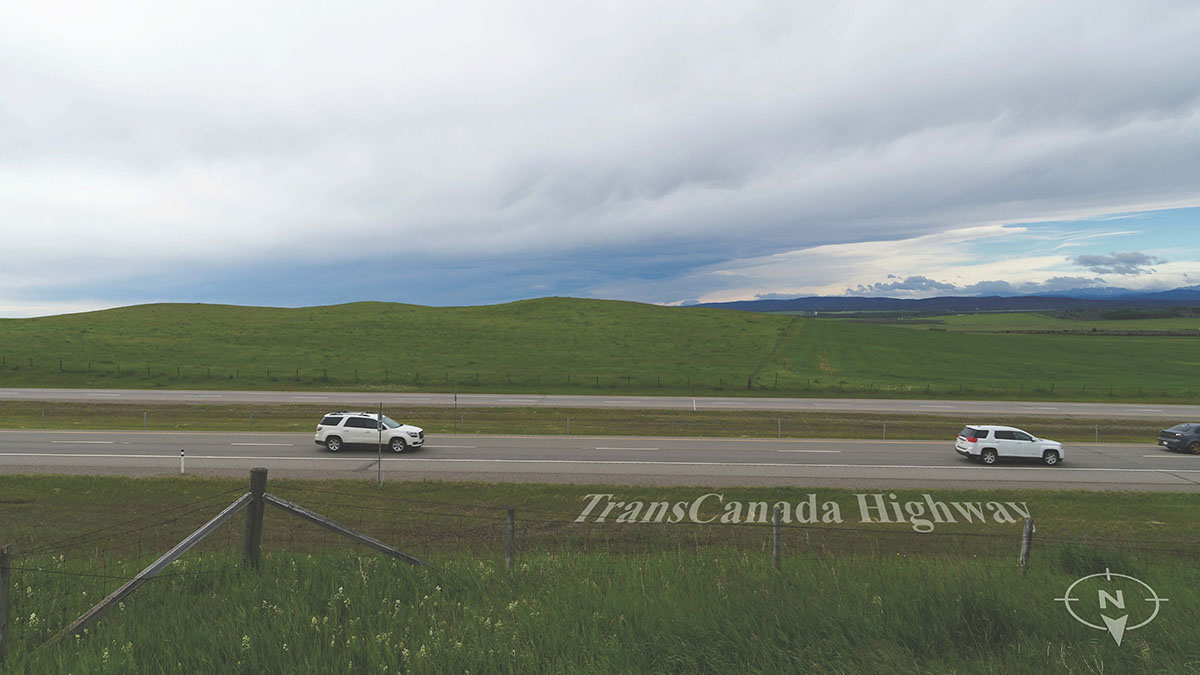 Original
2m elevation -
 Rendition
2m elevation -
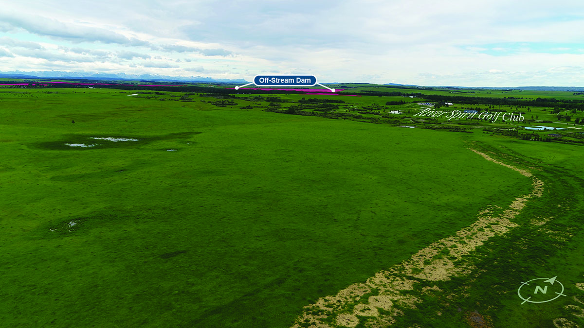
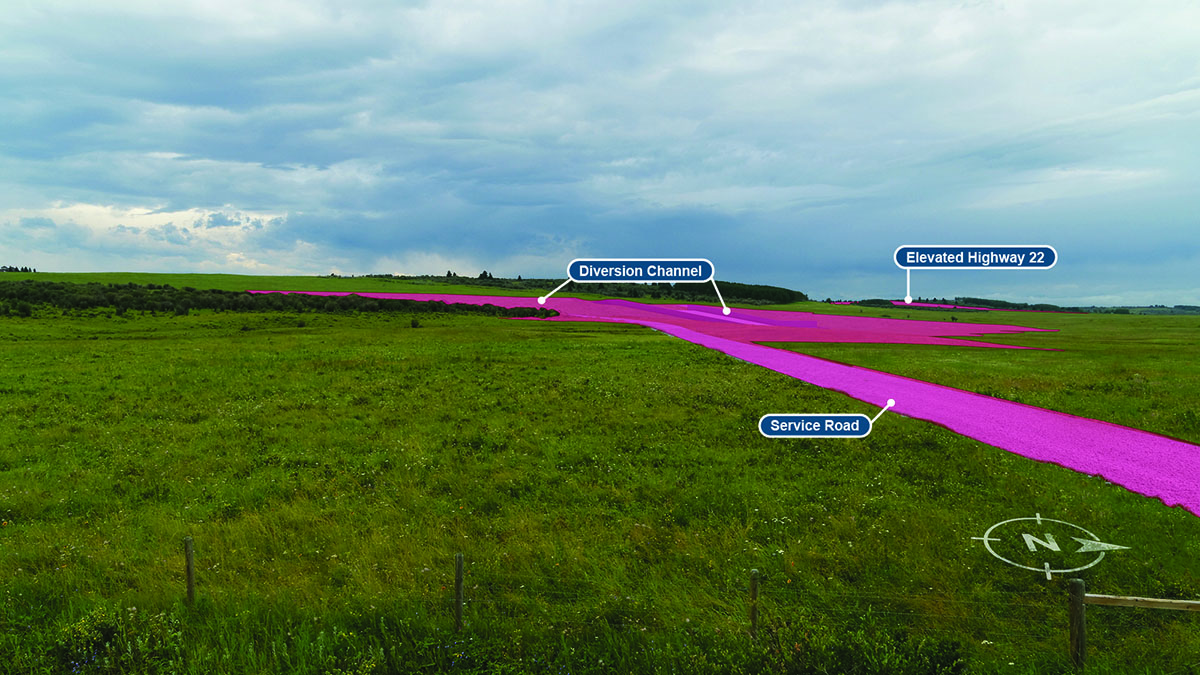
 Annotated rendition
2m elevation -
 Key map
61m elevation -
 Original
61m elevation -
 Rendition
61m elevation -
 Annotated rendition
61m elevation
-
 Key map
2m elevation -
 Original
2m elevation -
 Rendition
2m elevation -
 Annotated rendition
2m elevation -
 Key map
61m elevation -
 Original
61m elevation -
 Rendition
61m elevation -
 Annotated rendition
61m elevation
-
 Key map
2m elevation -
 Original
2m elevation -
 Rendition
2m elevation -
 Annotated rendition
2m elevation -
 Key map
61m elevation -
 Original
61m elevation -
 Rendition
61m elevation -
 Annotated rendition
61m elevation


-
 Key map
2m elevation -
 Original
2m elevation -
 Rendition
2m elevation -
 Annotated rendition
2m elevation -
 Key map
61m elevation -
 Original
61m elevation -
 Rendition
61m elevation -
 Annotated rendition
61m elevation


-
 Key map
2m elevation -
 Original
2m elevation -
 Rendition
2m elevation -
 Annotated rendition
2m elevation -
 Key map
61m elevation -
 Original
61m elevation -
 Rendition
61m elevation -
 Annotated rendition
61m elevation


-
 Key map
12m elevation -
 Original
12m elevation -
 Rendition
12m elevation -
 Annotated rendition
12m elevation
-
 Key map
2m elevation -
 Original
2m elevation -
 Rendition
2m elevation -
 Annotated rendition
2m elevation -
 Key map
61m elevation -
 Original
61m elevation -
 Rendition
61m elevation -
 Annotated rendition
61m elevation