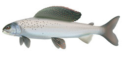
The Fish Sustainability Index (FSI) combines scientific and local knowledge to assess the health of Arctic Grayling in Alberta.
Arctic Grayling FSI Maps
Adult Density (Current and Historic)
- Current Adult Density Fish Sustainability (FSI) Rankings for Arctic Grayling
- Historic Adult Density Fish Sustainability (FSI) Rankings for Arctic Grayling
Please note that data reliability is not currently displayed in these figures.
Habitat and Overharvest Protection Needs
- Habitat Protection Needs Fish Sustainability (FSI) Rankings for Arctic Grayling, 2013
- Overharvest Protection Needs Fish Sustainability (FSI) rankings for Arctic Grayling, 2013
Please note that data reliability is not currently displayed in these figures.
The complete FSI spatial data layers can be viewed and downloaded in:
Arctic Grayling Population Status
In summary, Arctic Grayling in Alberta were found to be in serious decline, with degraded habitat and overfishing appearing to be the main causes (Figure 2).
Historically, Arctic Grayling were especially abundant and large in three primary areas of Alberta (Figure 1):
- the northern foothills (including the Swan Hills) near Edson, Fox Creek, and Grande Cache
- the rivers and streams in hilly areas surrounding Fort McMurray
- the Caribou Mountains west of Wood Buffalo National Park
In the remainder of their Alberta range, grayling were often moderately abundant.
Overall, current abundance has declined drastically, and the majority of Arctic Grayling watersheds are classified as high risk (Figure 1). Healthy populations remain only in a few remote and lightly disturbed watersheds.
Threats to Sustainability
The main threats to sustainability of Arctic Grayling were noted as:
- Sport fishing harvest, even at low levels, might be enough to prevent recovery of the remaining small and vulnerable populations. Of note, Arctic Grayling in the Little Smoky River have been protected with catch-and-release regulations since the late 1980's, and remain healthy.
- Water quality in heavily-developed watersheds, like the Beaverlodge and Tawatinaw rivers, has declined and once-abundant grayling have been lost.
- Roads, pipelines, clearcuts, seismic lines and other land changes may have altered ground and surface water flow, causing streams to experience more severe floods and droughts and reducing grayling habitat quality.
- Summer water temperatures in many Alberta grayling streams appear to be increasing, leaving only the higher-elevations areas as prime grayling habitat.
- Given their need to access multiple habitats throughout their life cycle, the fragmentation of grayling habitat by culvert road-crossings can affect the long-term sustainability of Arctic Grayling populations.
Next Steps
- Land use must be included in any successful recovery program for Arctic Grayling (Figure 2). Biologists are focusing on Arctic Grayling as the primary fisheries indicator for planning and management in the Land-use Framework in their affected watersheds. This will involve the cooperation of industries including agriculture, oil and gas, and forestry.
- Fisheries management objectives will be set for grayling populations in Alberta. Generally, grayling populations will need to be recovered to low risk (healthy) conditions. Based on the success of catch-and-release regulations in a few watersheds, this may be expanded provincewide. A few of the most severely affected grayling populations (Figure 2) could have short-term closures to fishing.
- Successful grayling recovery will require considerable work, including extensive adaptive management experiments on whole watersheds. The quality of non-standardized monitoring programs has been a problem, as grayling are migratory, are at low densities, and can be difficult to capture with standard fisheries techniques such as index-netting and electrofishing. Intensive studies using stream counting fences are a promising (but expensive) option.